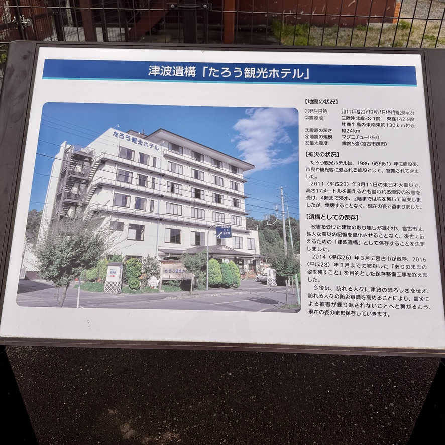
Miyako City and the nearby coastal towns were completely raved by the tsunami generated by the great earthquake in March of 2011. I have had a life-long infatuation with tsunamis. Consequently, I had to see first hand what I had only witnessed through watching hours upon hours of Youtube videos at that time. I encourage you after viewing this post to watch some of these for yourself. There are at least one-hundred or more. I hired a local tour guide to explain it all. He was a resident and was here on March 11, 2011 to witness the event.
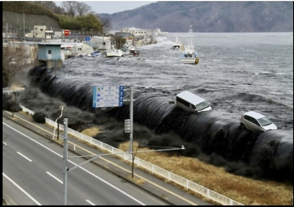
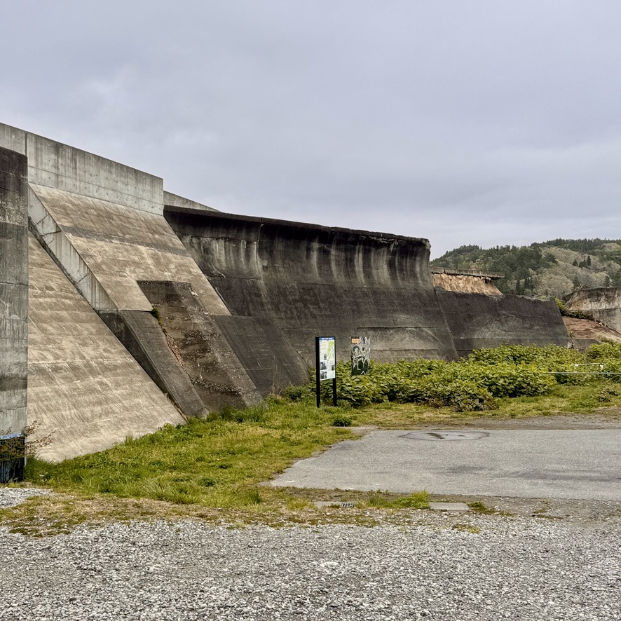
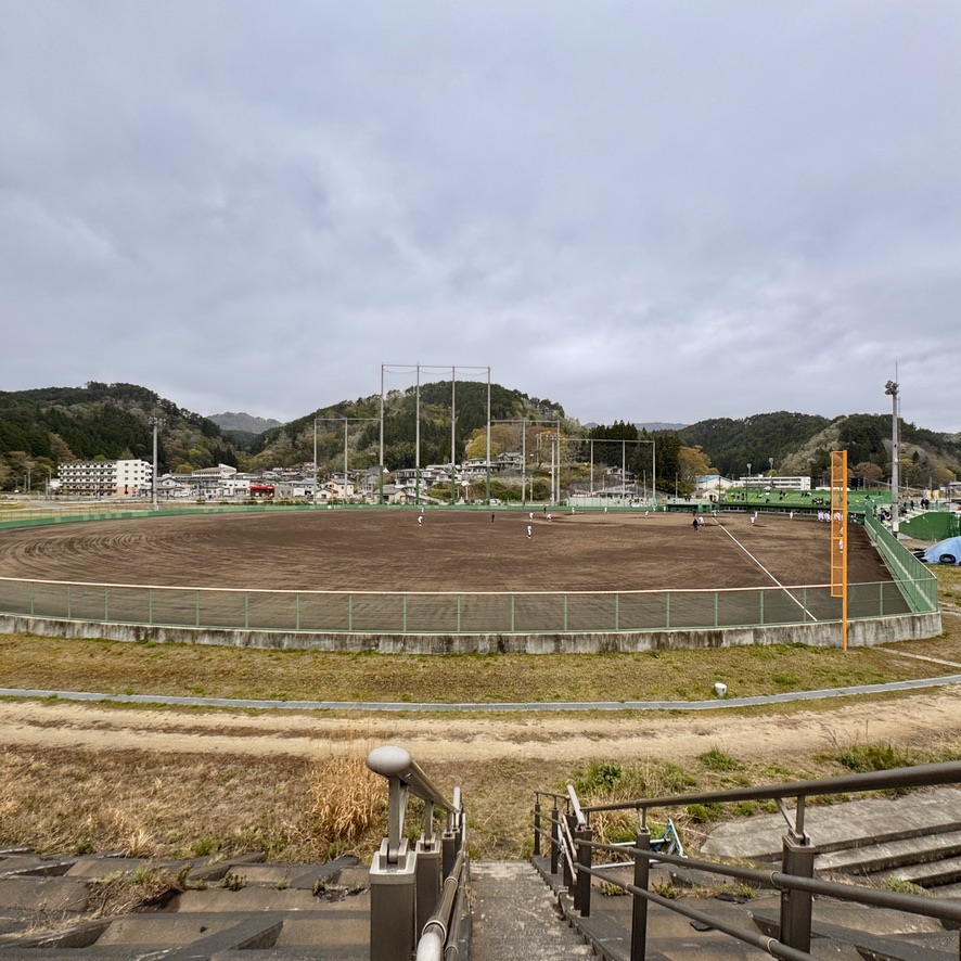
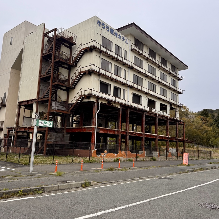
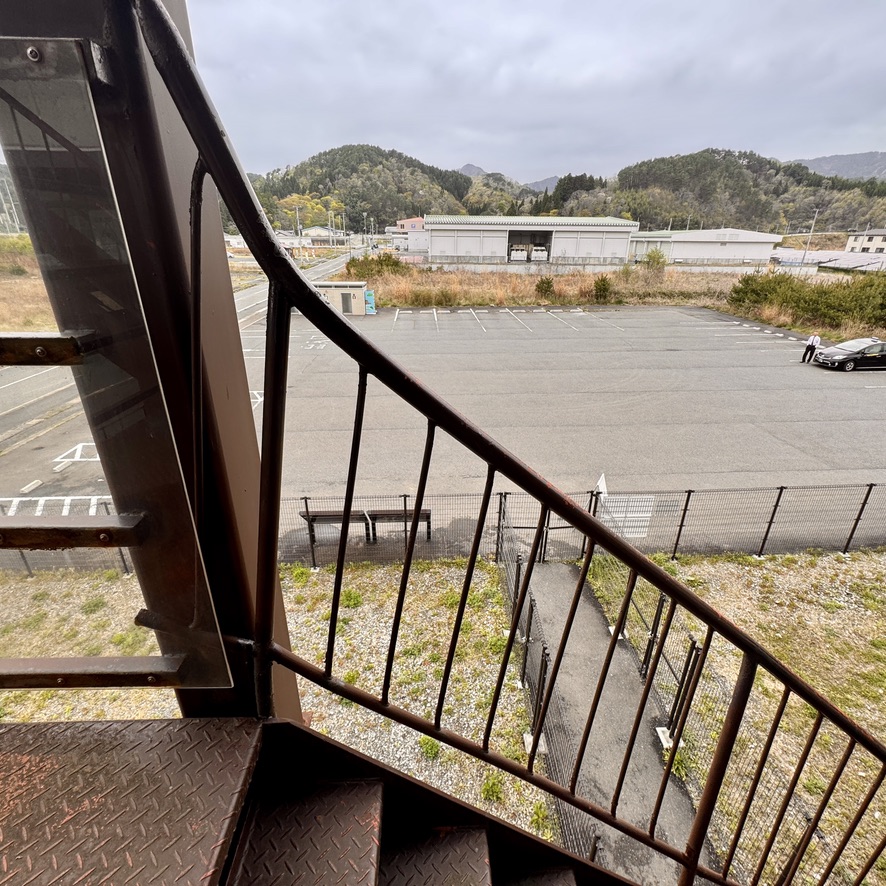
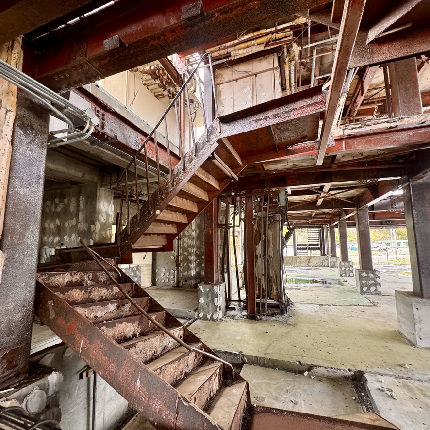
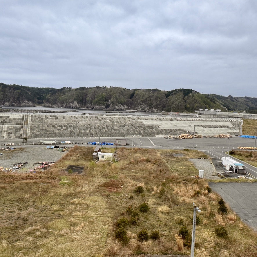
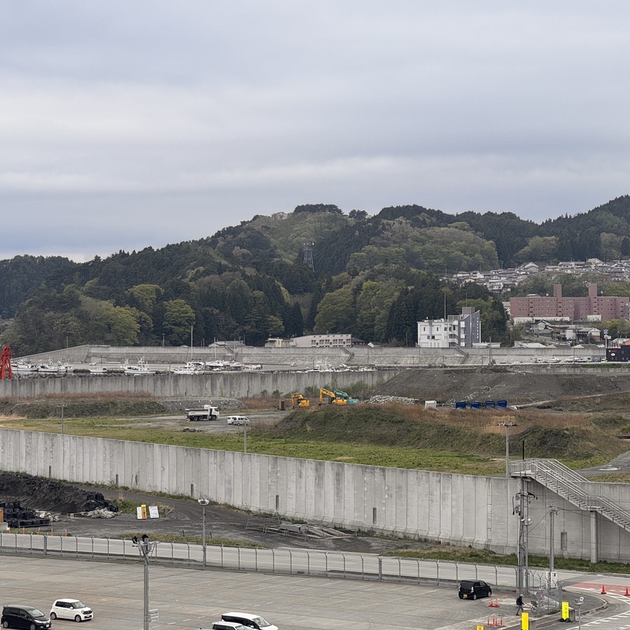
March 11, 2011 tsunami breaching the old seawall.. More than 200 people were killed or never found.Seawalls were constructed to protect the town. The darker walls are older and standing at 10 meters were the ones breached by the 2011 event. The newer walls are quite a bit higher. Whether they are high enough will be determined by the next inevitable tsunami.The area just inside the seawall is no longer filled with homes and neighborhoods, but rather a baseball field.The 2011 tsunami height was more than 16 meters (or 53-60 feet) at this point. If you zoom in on the building it is marked by the orange marker nearest the roofline. The tsunamis of 1896 was 15 meters and the one in 1933 was 10 meters. Their heights are also indicated by markers on the building.The popular hotel Taro Kanko as it existed before the 2011 tsunami.The hotel as it stands today is now a memorial to that fated event of 2011. As can be seen, the first two floors were completely washed out. The water eventually rose to the 6th floor, completely inundating the bottom 5 floors. The hotel’s owner filmed the event in a never released video from the top floor.Iron handrails were reshaped by the wave’s force. I wouldn’t have imagined that the water could bend steel in this way.Inside the hotel I captured this image of the washed-out first and second floors.The view from the top floor in the hotel where its owner recorded the event. The field below had been home to several hundred families, including my tour guide. After we left the hotel we walked across the field to where his house once stood. So sad. Today there are many more seawalls protecting this area which is so very prone to suffering another tsunami.
I’m headed north on the main island of Japan. Hope to have an entry from another interesting place.
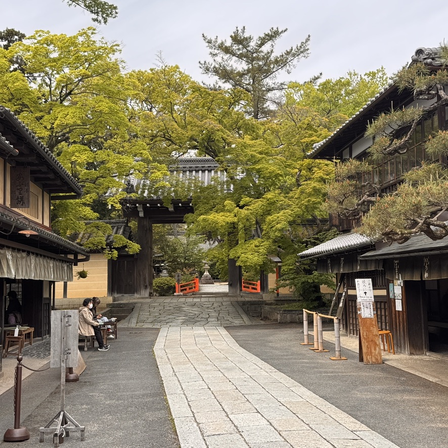
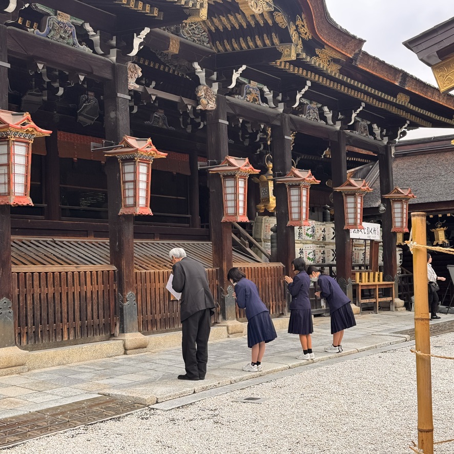
Kyoto is different than Tokyo and other large Japanese cities in that it was spared from the bombings during WWII. Consequently, its buildings and neighborhoods are much older. While there is plenty here to do, I spent most of my time eating my way around this great city. With over 100 Michelin-starred restaurants, the culinary experiences offered in Kyoto are some of the best in the world. It is a very walkable city as well. Because my culinary endeavors consumed so much of my time here, I only had time for one bike tour. I selected one in the Gion district and it was a great way to visit the shrines, temples and some quiet neighborhoods there.
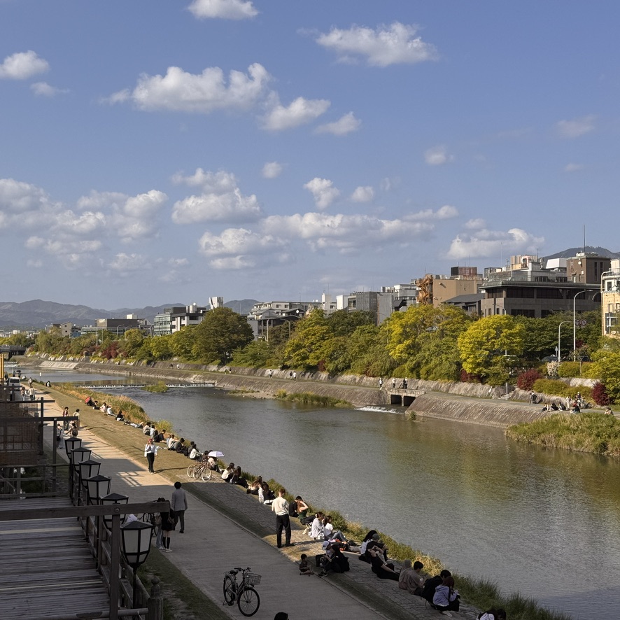
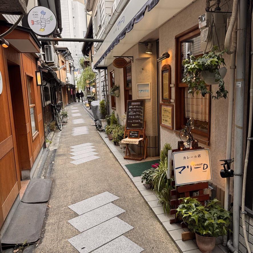
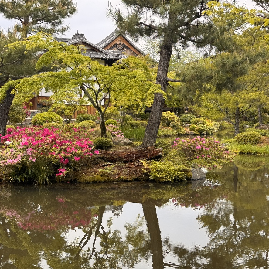
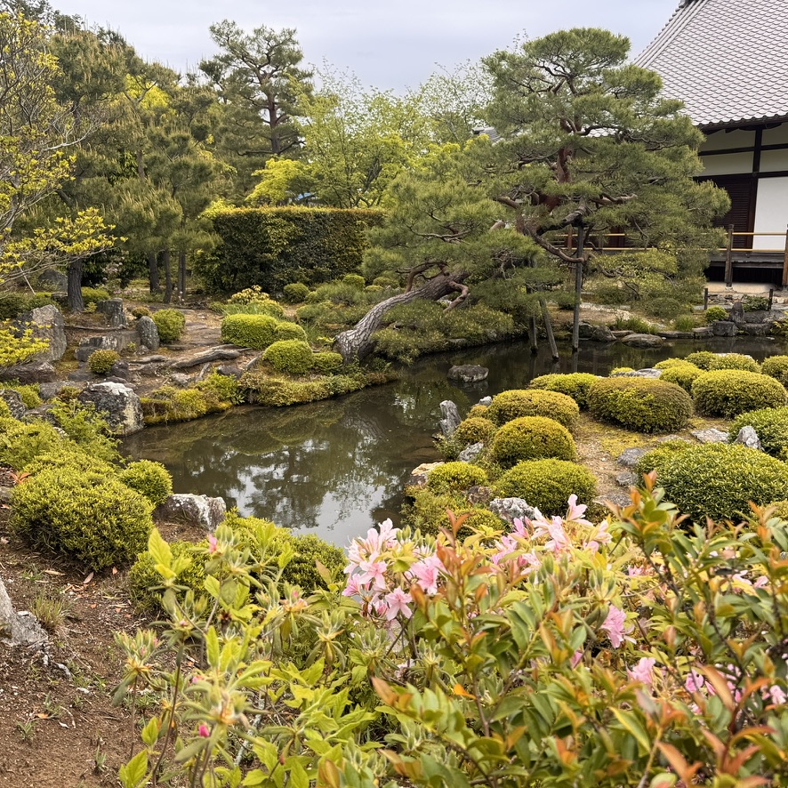
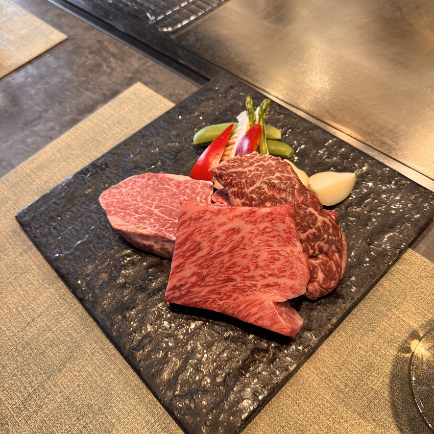
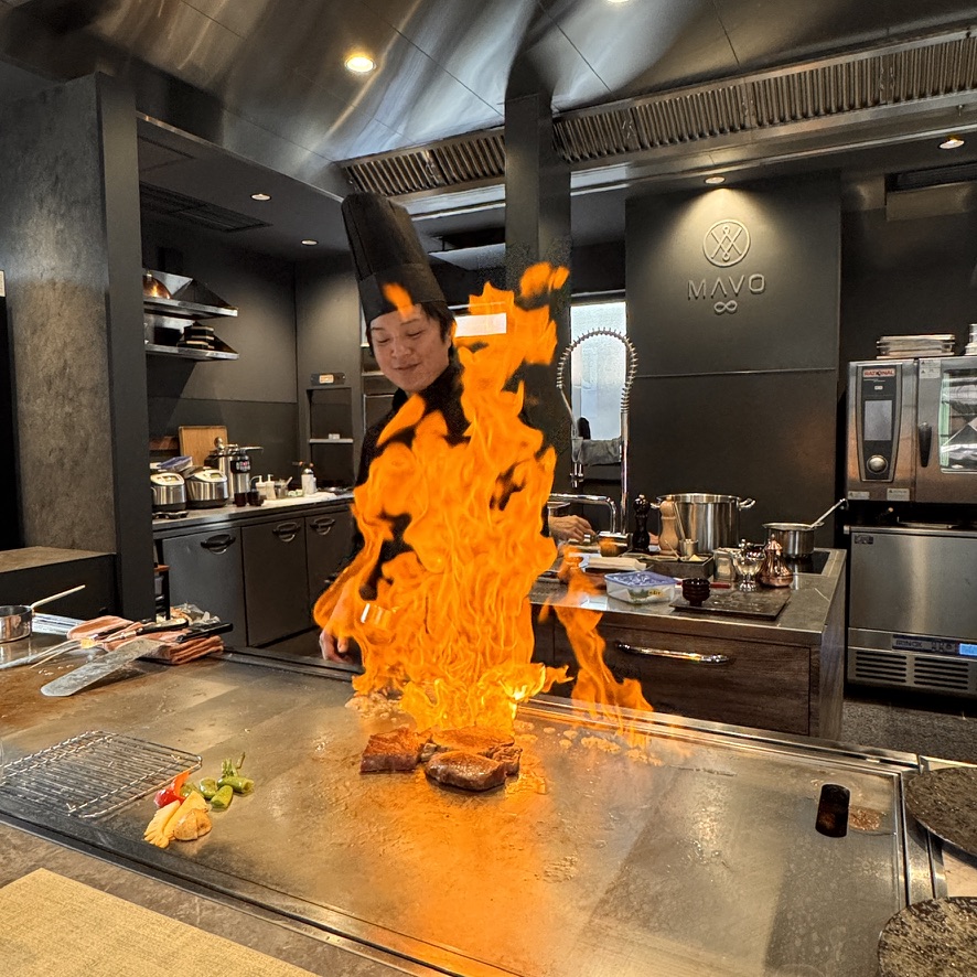
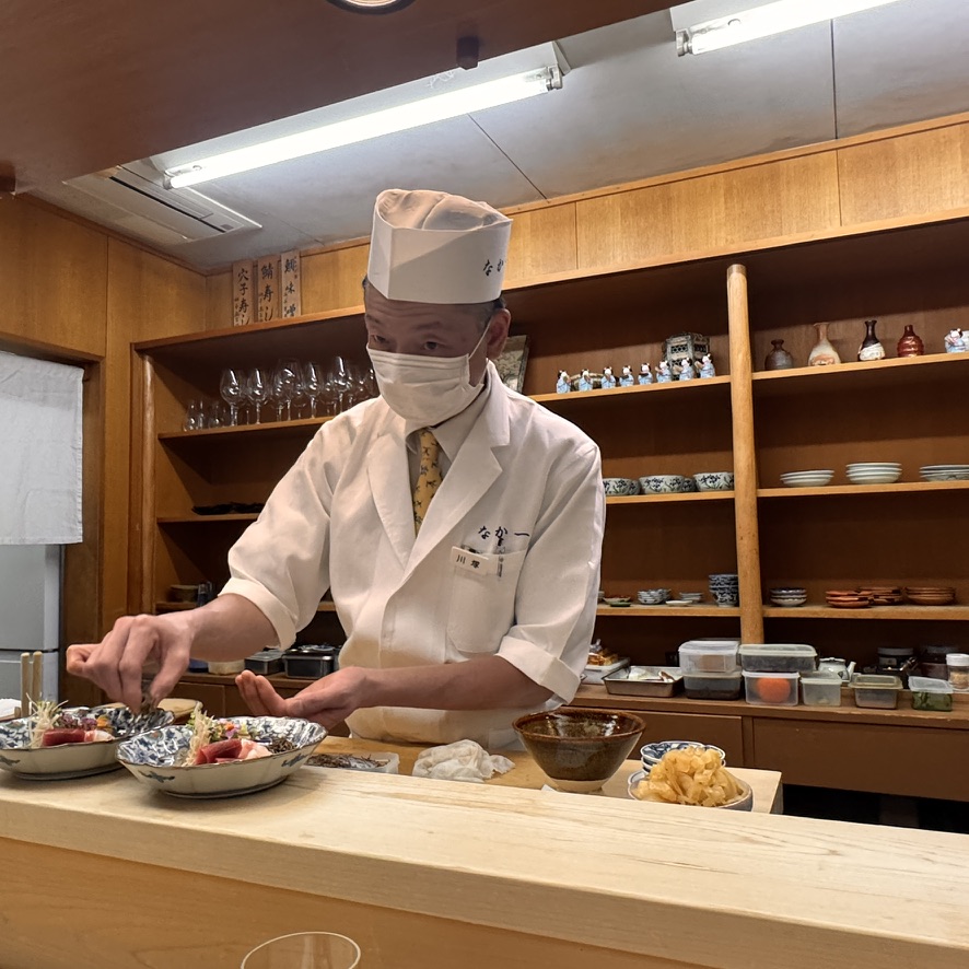
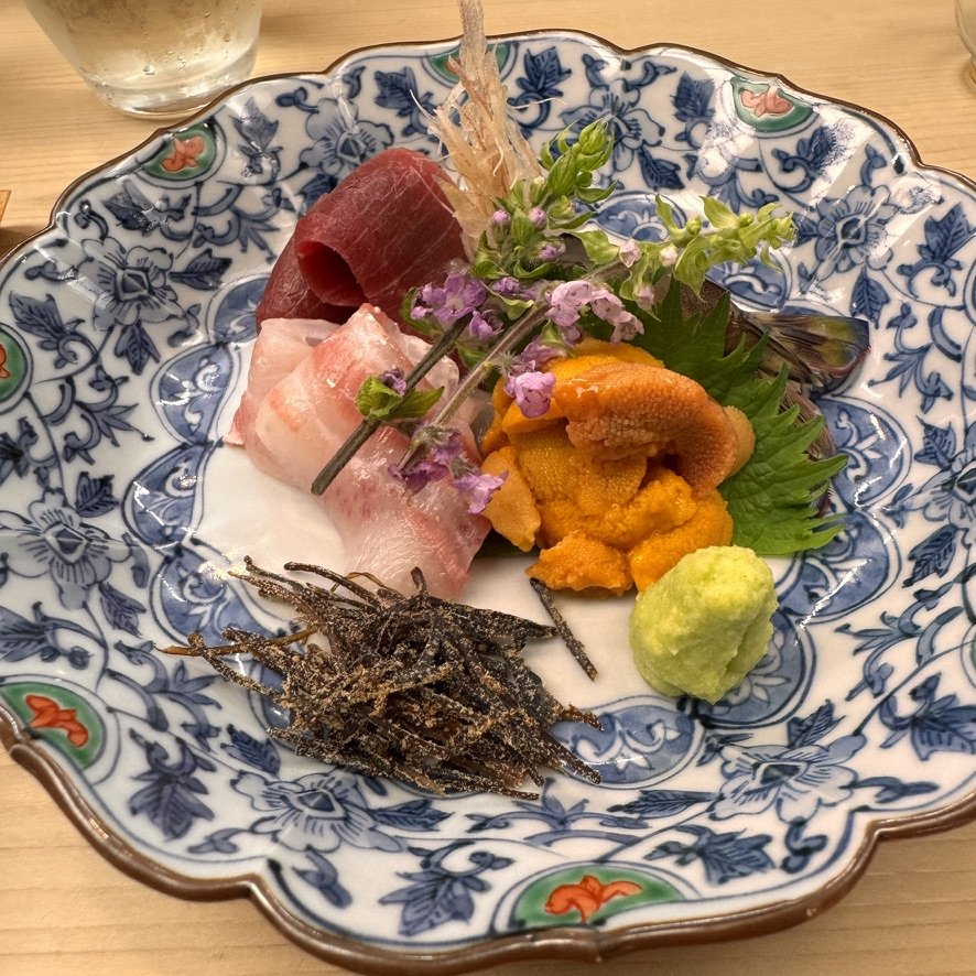
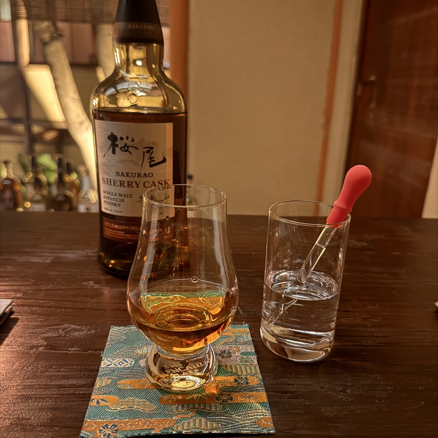
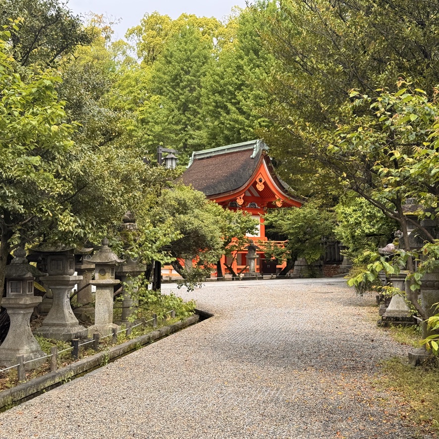
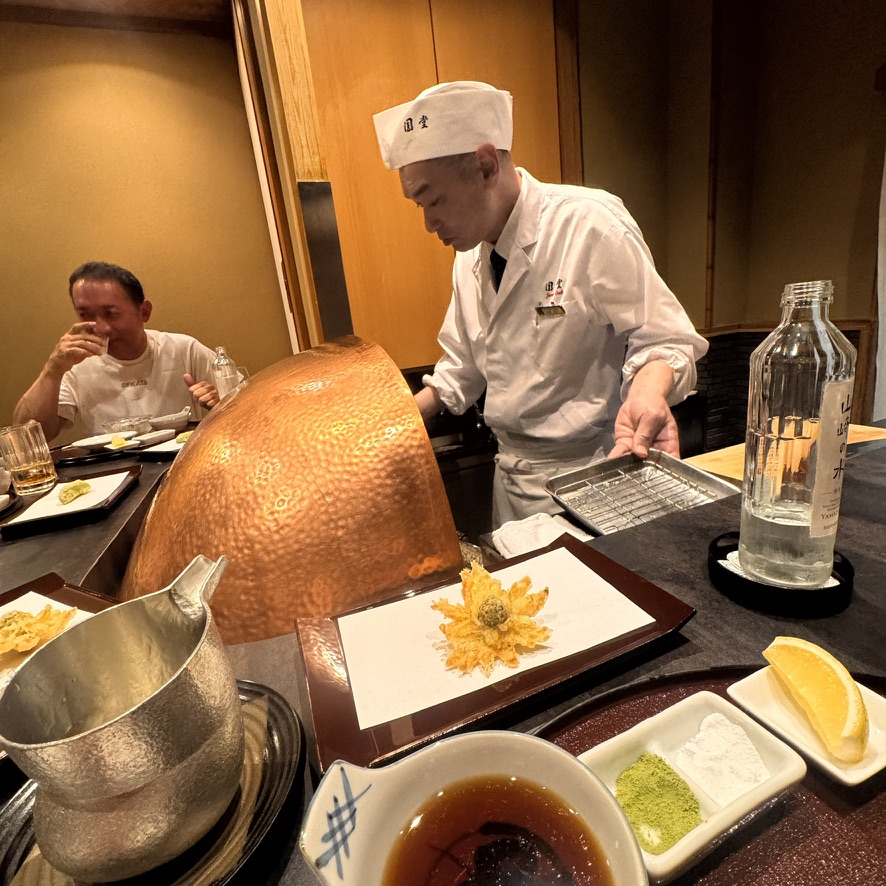
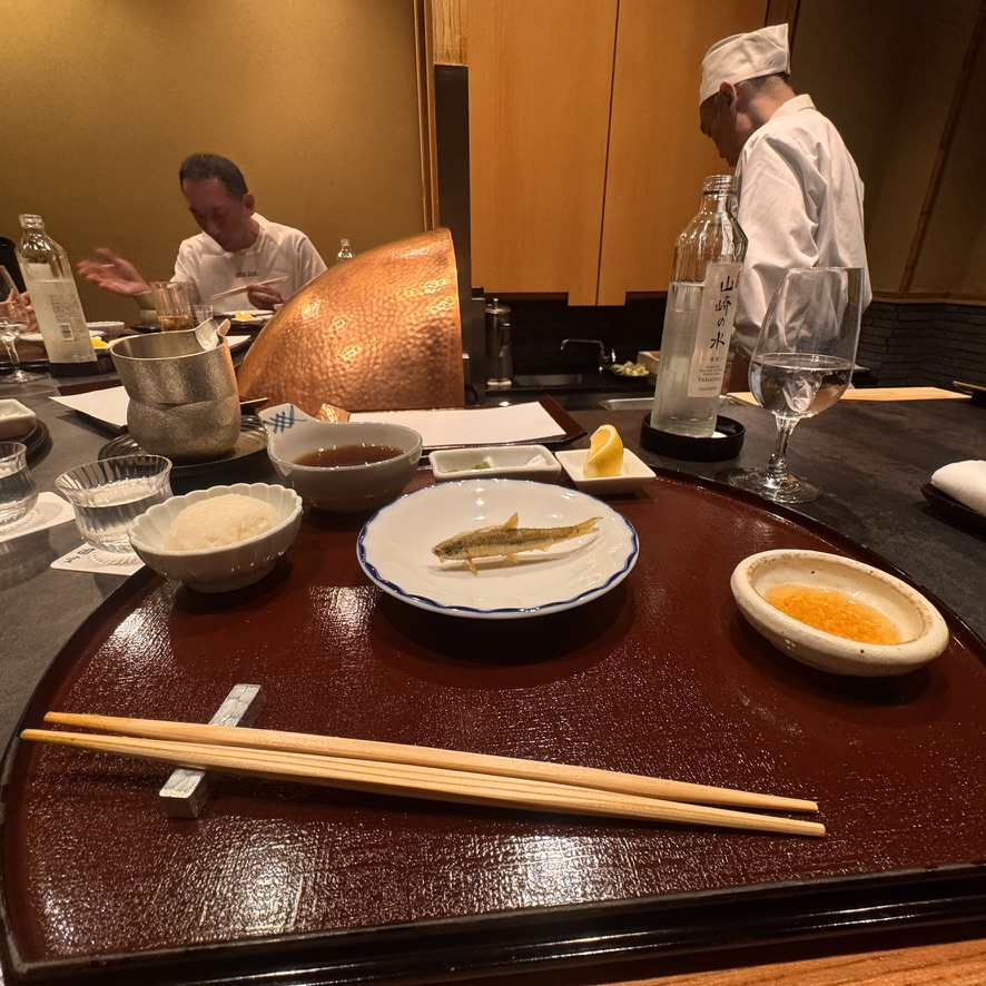
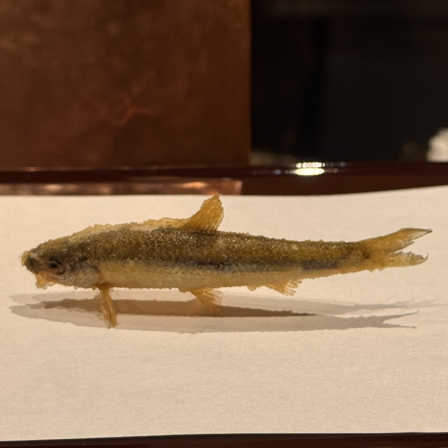
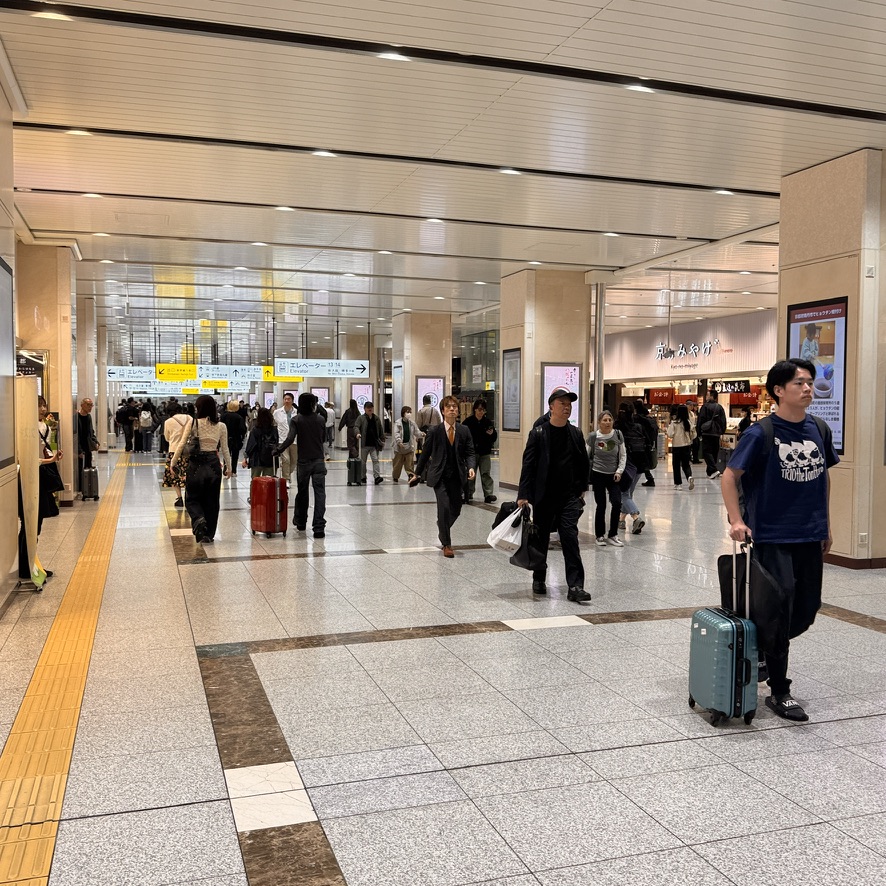
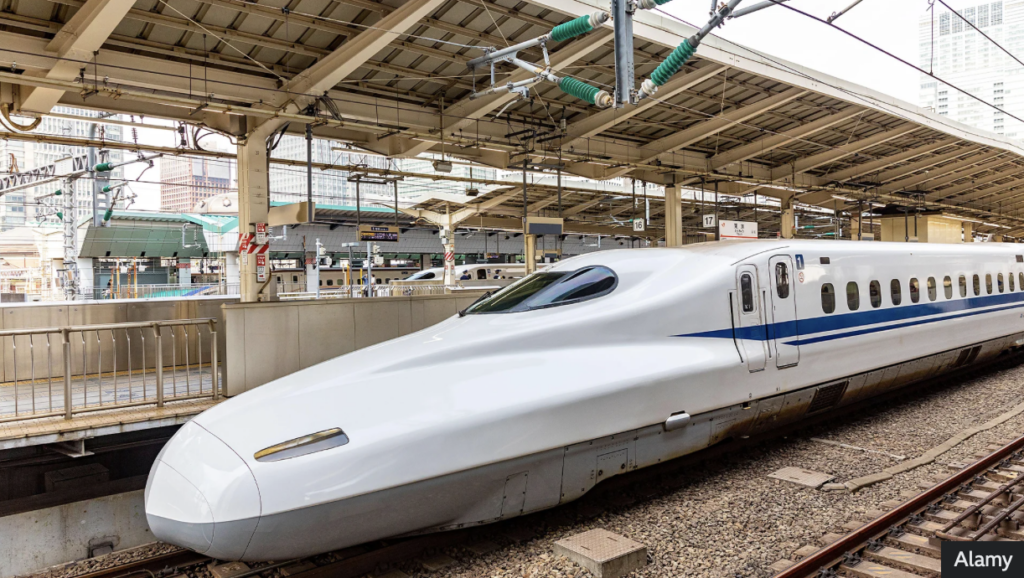
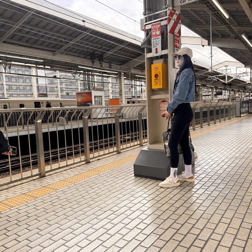
The river Kamo or Kamogawa runs through Kyoto.Small shopping districts abound, as well as cozy alleyways with small eateries.On the bike tour we stopped at the oldest tea house in Japan. It is here in Kyoto’s Gion district.Zen gardens are a large part of this shrine’s appeal. The shrine is known as Kennin-ji and is located in the quiet area in Gion.Another image of the beautiful gardens.I couldn’t pass up the opportunity for a late Wagyu lunch. These were the cuts of the day’s offerings. The darker cut is a Kobe sirloin. The other two are Wagyu, one filet and the other, a sirloin. They are all so well marbled.And the chef puts on quite a show as well. Since you sit at the bar just a few feet away, the flash of heat could definitely be felt. Cooked medium-rare this beef was amazing.Later that night I dined at Sushi Kappa Nakaichi, an omakaze where the chef was all business. Each piece was a carefully crafted work of art. What an artist. This was but one of the many creations that night. And the perfect way to cap-off a great day of dining experiences was to indulge in a fine Japanese single malt whiskey. The bartender at the Sowaka Hotel’s bar was great. I described what I preferred in a single malt scotch, and he accommodated me with a Japanese whiskey with similar characteristics.As a demonstration of respect, ritual bowing is always seen. One of the temples seen on the bike tour.Different day and a different dinner. I chose Tempura Endo Yasaka Honten. It is a renowned, century-old tempura restaurant in the Gion district of Kyoto. I always choose omakaze since it’s hard to identify many of the options being offered. This way the chef chooses only the best. The tempura was a thin glaze, rather than a breading. It was translucent so although you tasted it, the tempura never overpowered the food. The chef instructed which dip was for each different bite he made for you.Extreme close-up demonstrating just how light and delicate the tempura glaze was.Kyoto station is clean, bright, and offers one last shopping experience before you leave Kyoto. The bullet back to Tokyo. The 230 mile trip took just over 2 hours. That included 3 or 4 brief stops. These trains are truly awesome.I noticed this mysterious woman on the platform for the train bound for Tokyo. I wasn’t sure what was going on here. Until this point the only masks I saw in Japan were of the N-95 variety. She was definately stying, and that mask is for sure a custom fit. Zoom in and take a look.
That’s it from Kyoto. Now I am on my way back to Tokyo and then I have a few days to visit a couple of small towns in northern Japan. I’m not sure exactly which ones they will be. See you there when I figure it out.
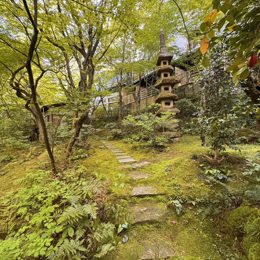
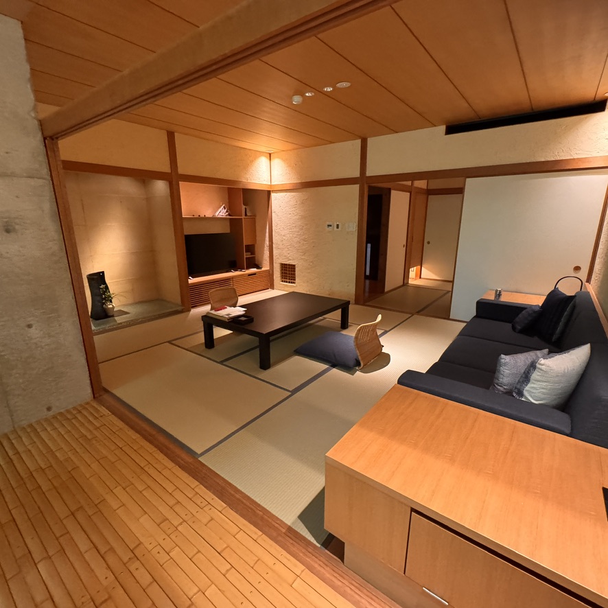
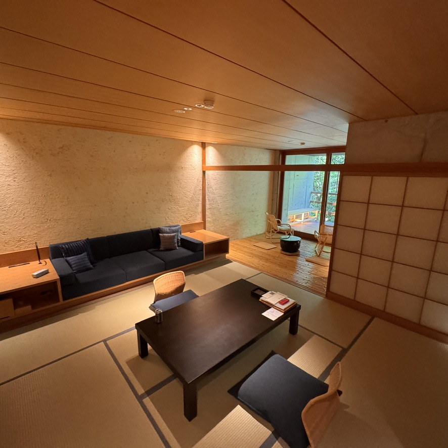
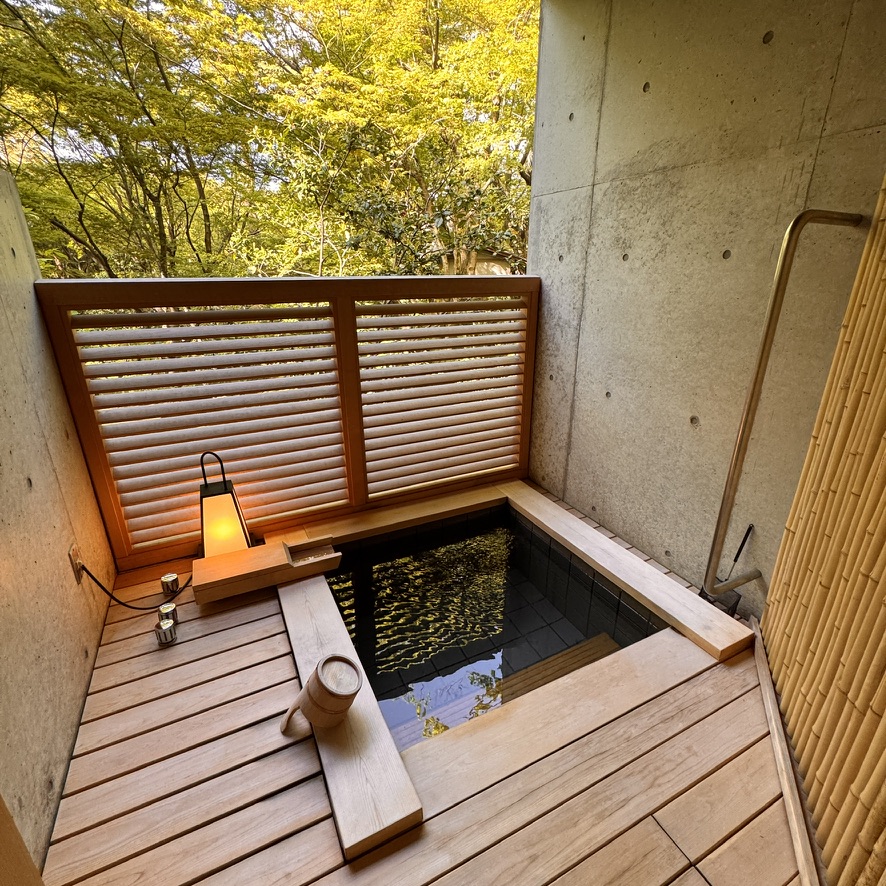
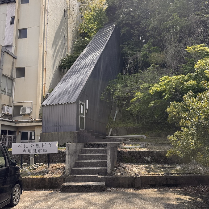
After the hustle and bustle of Tokyo I thought it was a good idea to change up the pace. Consequently, I headed west to Yamashiro Onsen, a hot spring resort area in the city of Kaga. I decided to stay at a ryokan by the name of Beniya Mukayu. A small resort with only 17 rooms, it is nestled in the hillside above the town. As a guest you can leave most of your clothing packed. You wear the freshly laundered kimonos that are hanging in your closet. I remained on-sight the entire time but for one excursion to the town below.
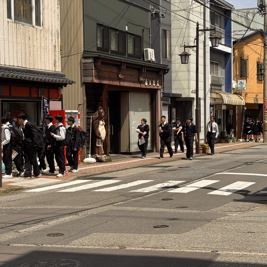
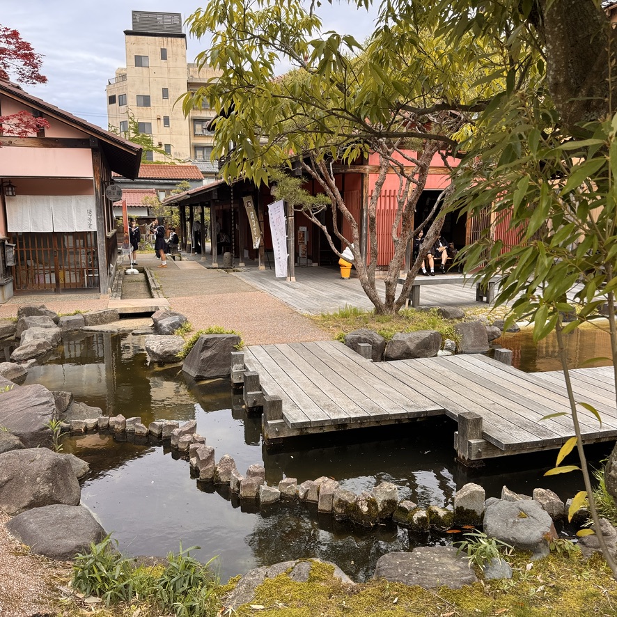
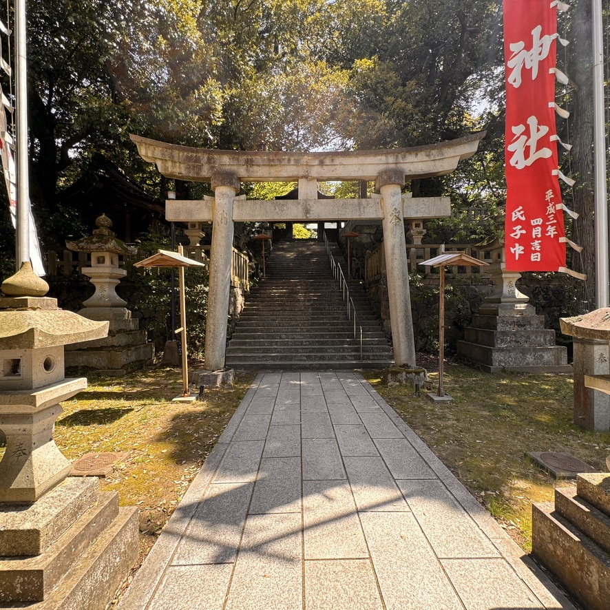
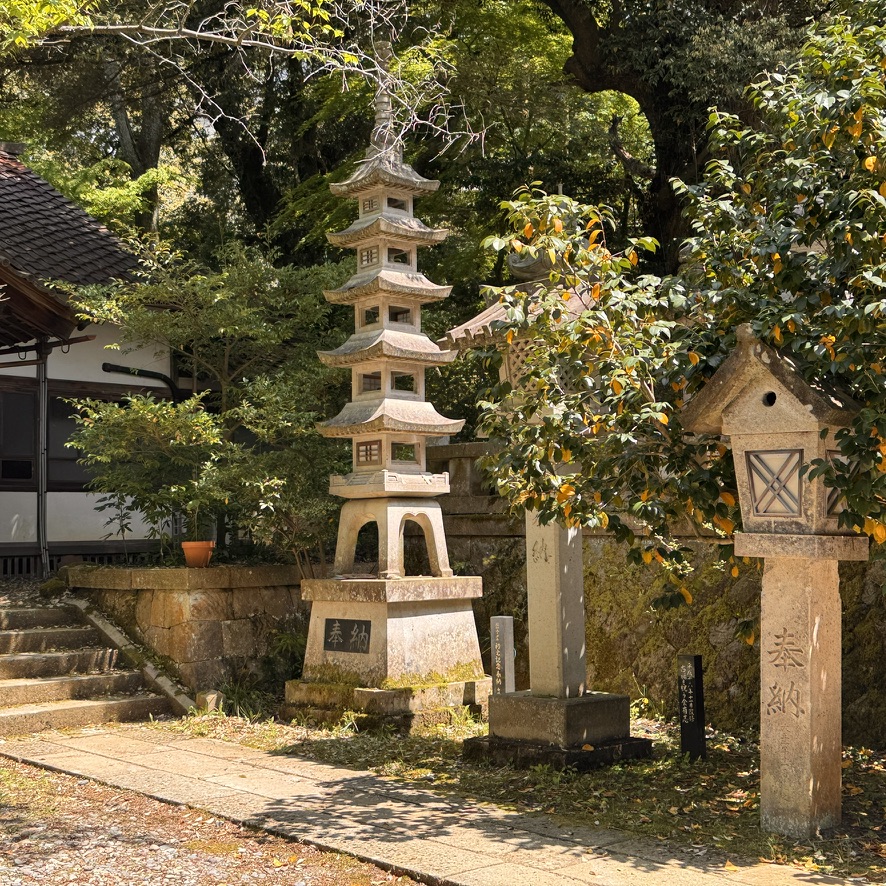
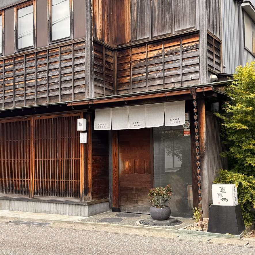
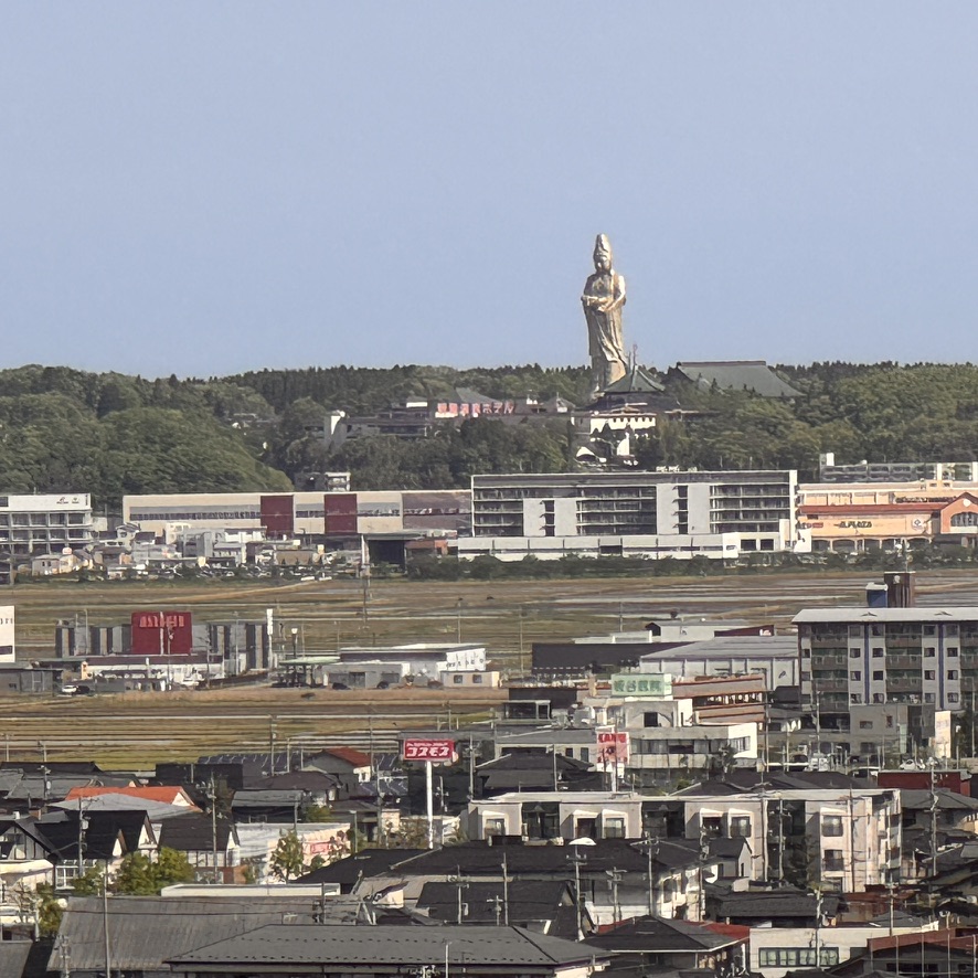
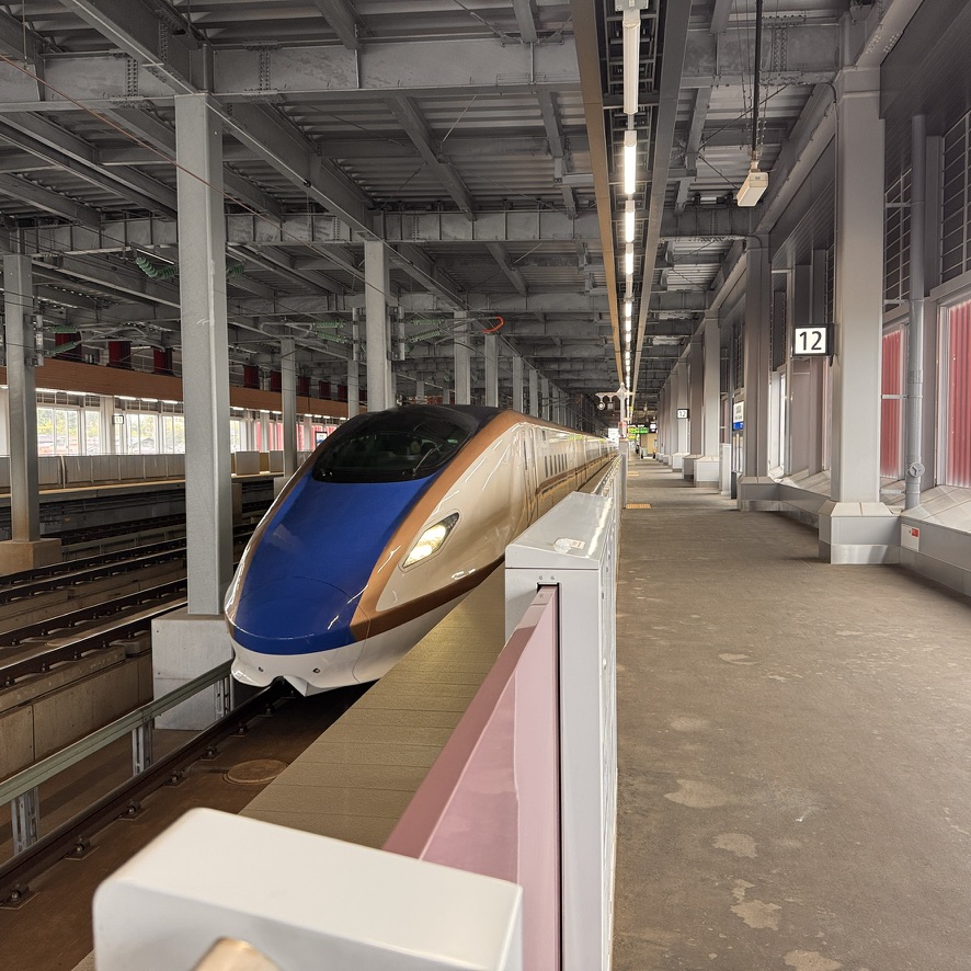
A stroll through the gardens at the resort can be relaxing before the traditional Japanese breakfast.The minimalistic room design affords both practicality and comfort at the ryokan.Another perspective of the accommodations.Included is your private mineral bath accessible just through the shower.This is the funicular from the ryokan to the town. Kids on a field trip to the town.These kids are so friendly. I tried unsuccessfully to buy a tea from a vending machine. After walking away empty handed, these kids bought it and followed me down the street to give me a “present.” All they wanted in exchange was a picture, which was taken by their teacher.. Another image of this quiet little town.No town is complete without the ubiquitous shrine. This shrine occupied several acres of beautiful grounds.On the shrine’s grounds were several sculptures. You would never know that this awesome sushi restaurant was open. It sure appeared to be closed. Lunch was incredible. Pictured is the colossal Buddha. The statue stands 73 meters tall and was built as part of a now abandoned spiritual theme park resort.My bullet train to Kyoto was right on-time, as I have now become accustomed. Japan just runs great.
Now a relatively short train ride to Kyoto for a few days. I hope you will join me.
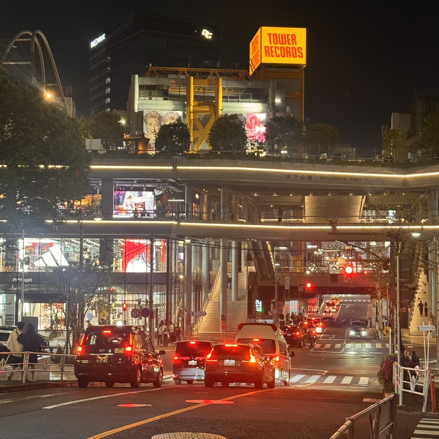
As a tourist of planet Earth for the past 20-30 years, Japan is the closest utopian experience I have ever had as a traveler. The people are warm, welcoming, respectful, and helpful. The culture is more passive than anything else I have witnessed anywhere. The country is the cleanest I have ever experienced in a first world location. The diverse culinary experiences it offers the world are incredible. I spent five nights in Tokyo. The first two at the Trunk Hotel Yoyogi Park. This hotel is a small boutique hotel in a newer neighborhood right on Yoyogi Park. It is in the Shibuya ward or district. Then I spent a couple of nights at its sister hotel the Trunk Hotel on Cat Street. This area has a more electric feel because of its bustling location. After that I relocated to the Mandarin Oriental Hotel, because of its proximity to the Tokyo train station for my upcoming travels to the mountains in the northwestern part of the country.
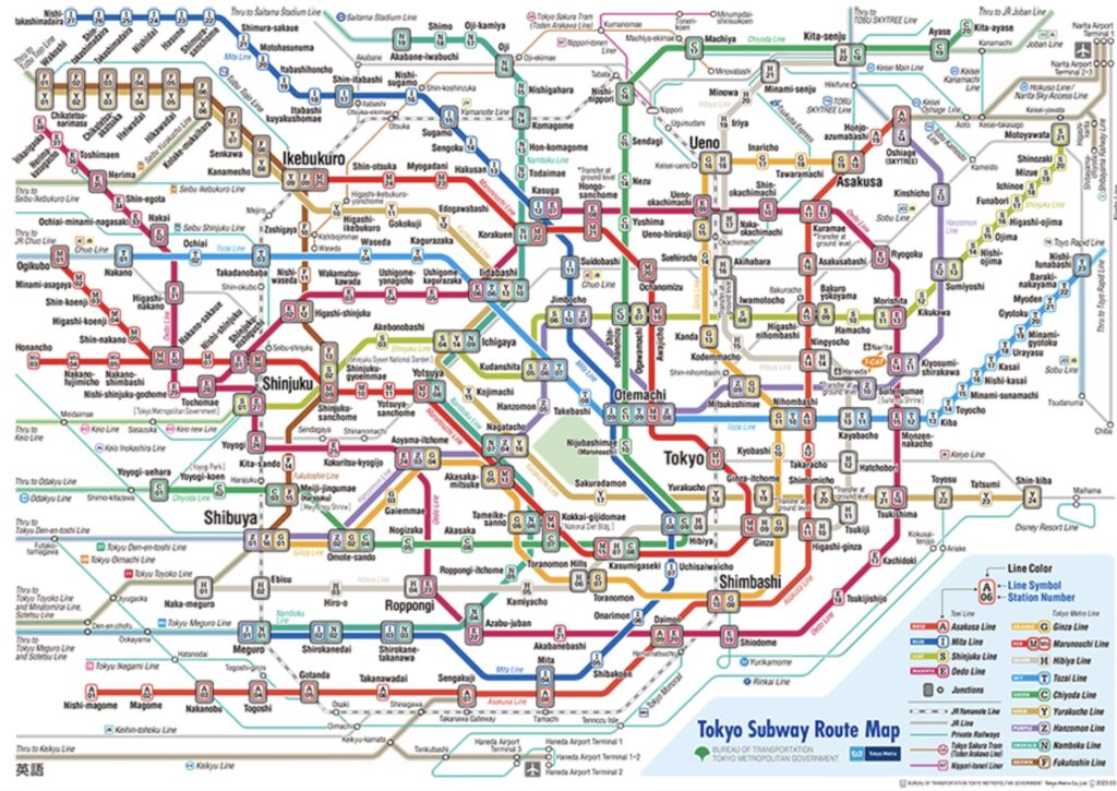
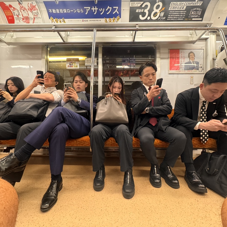
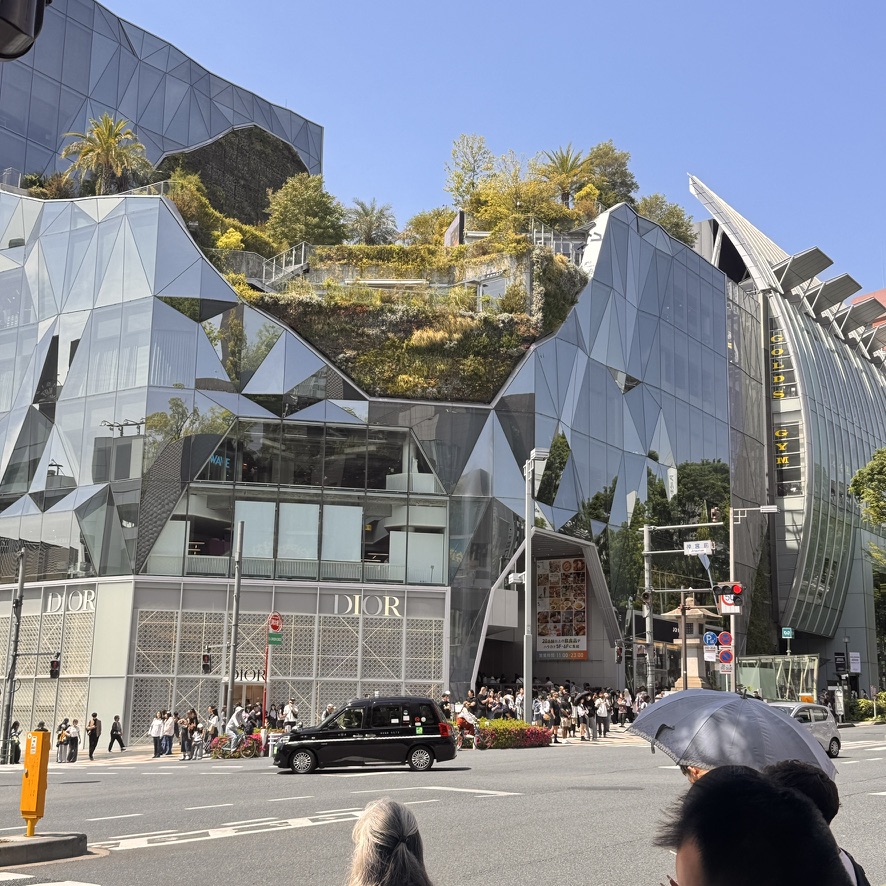
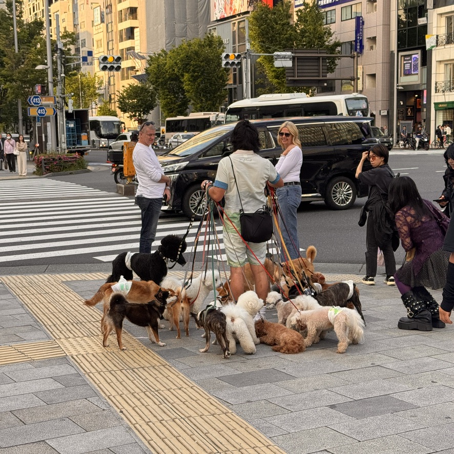
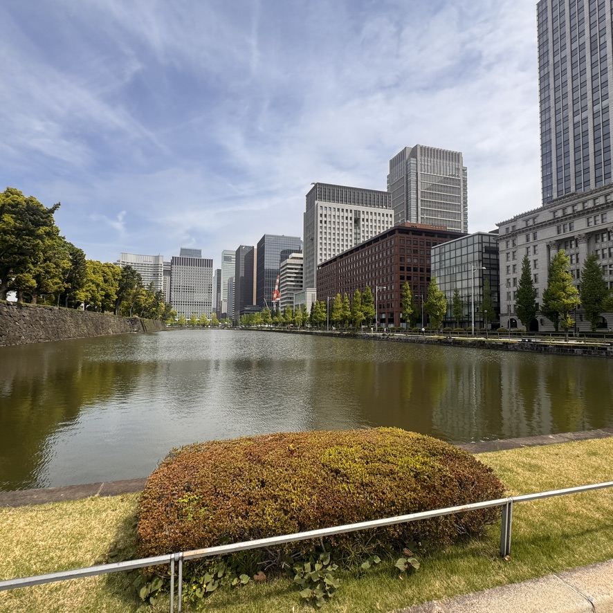
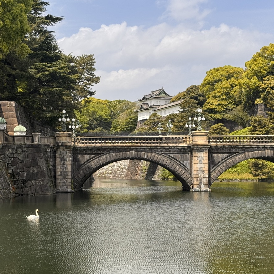
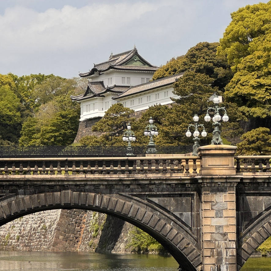
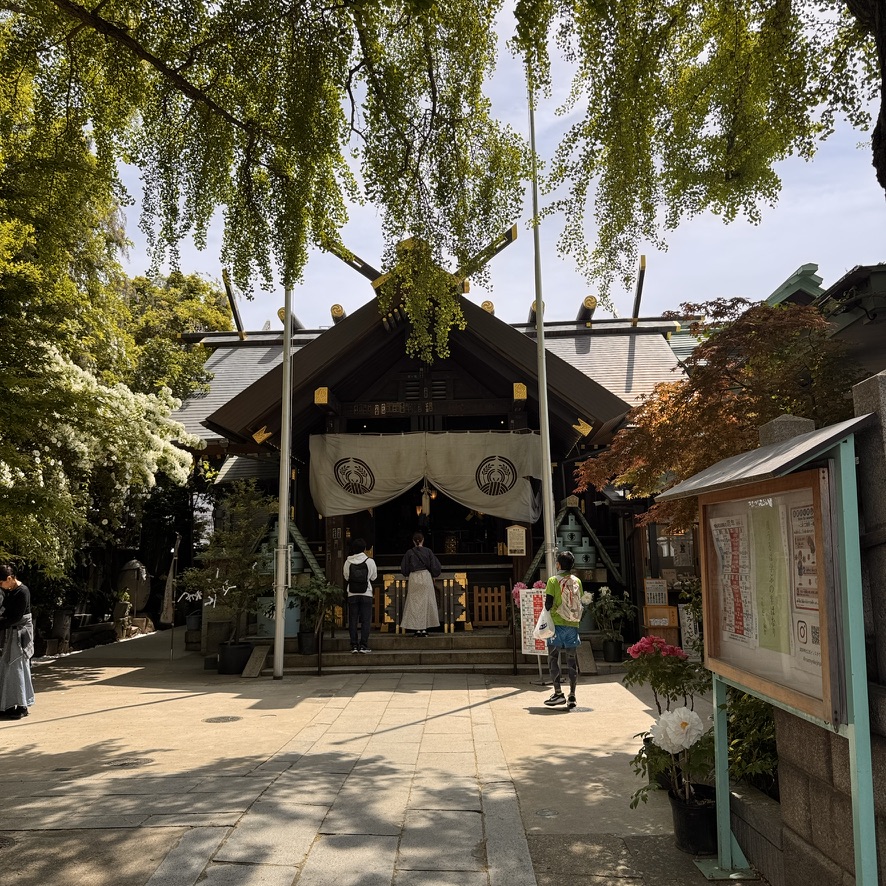
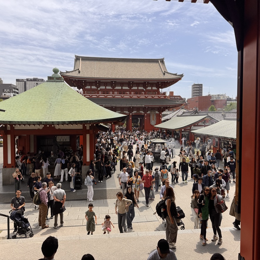
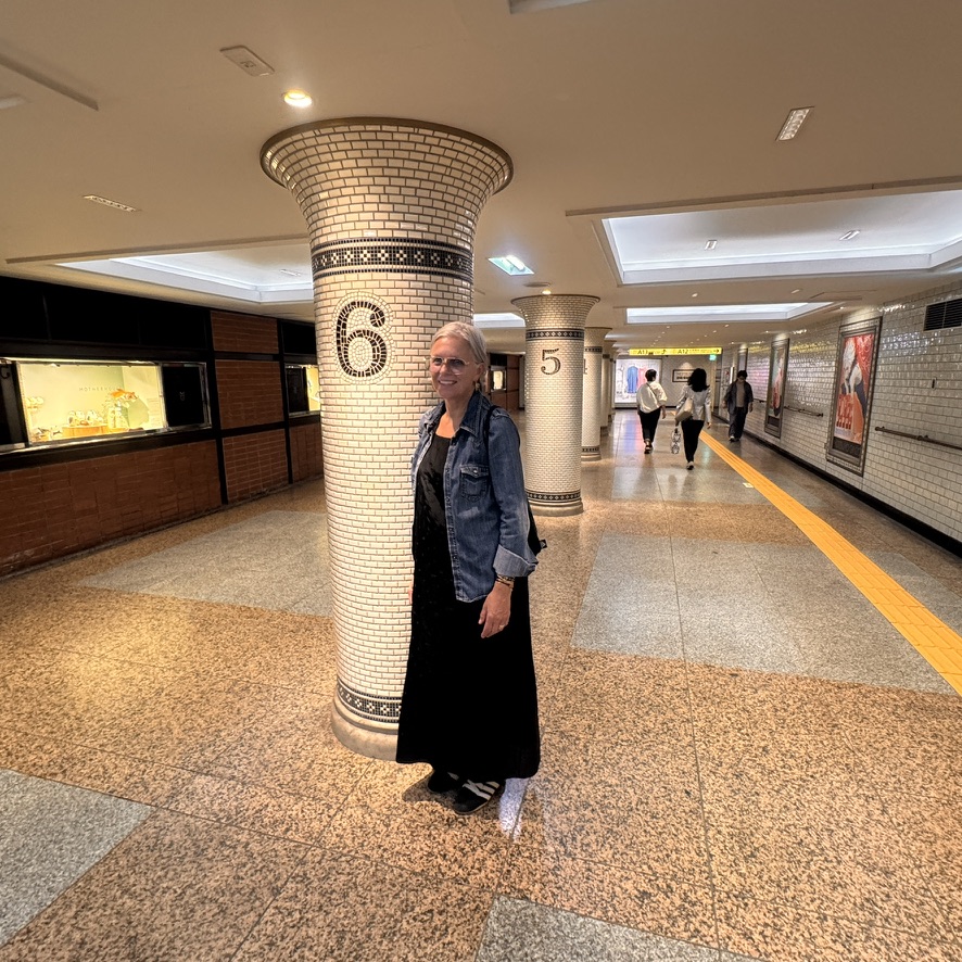
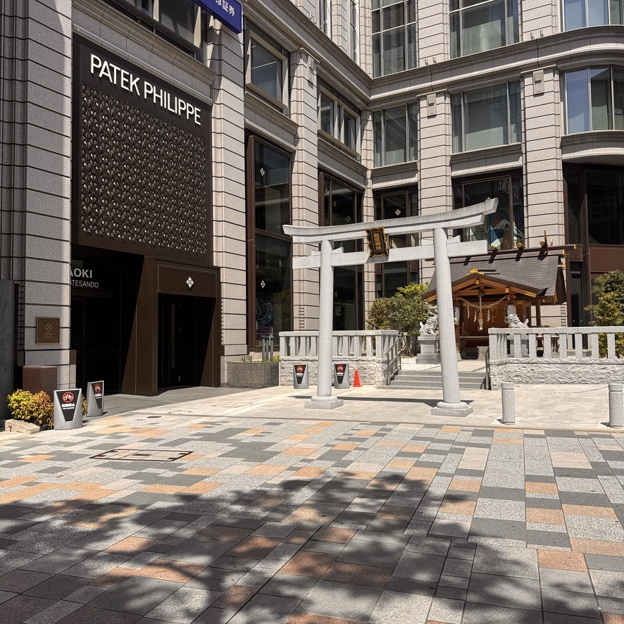
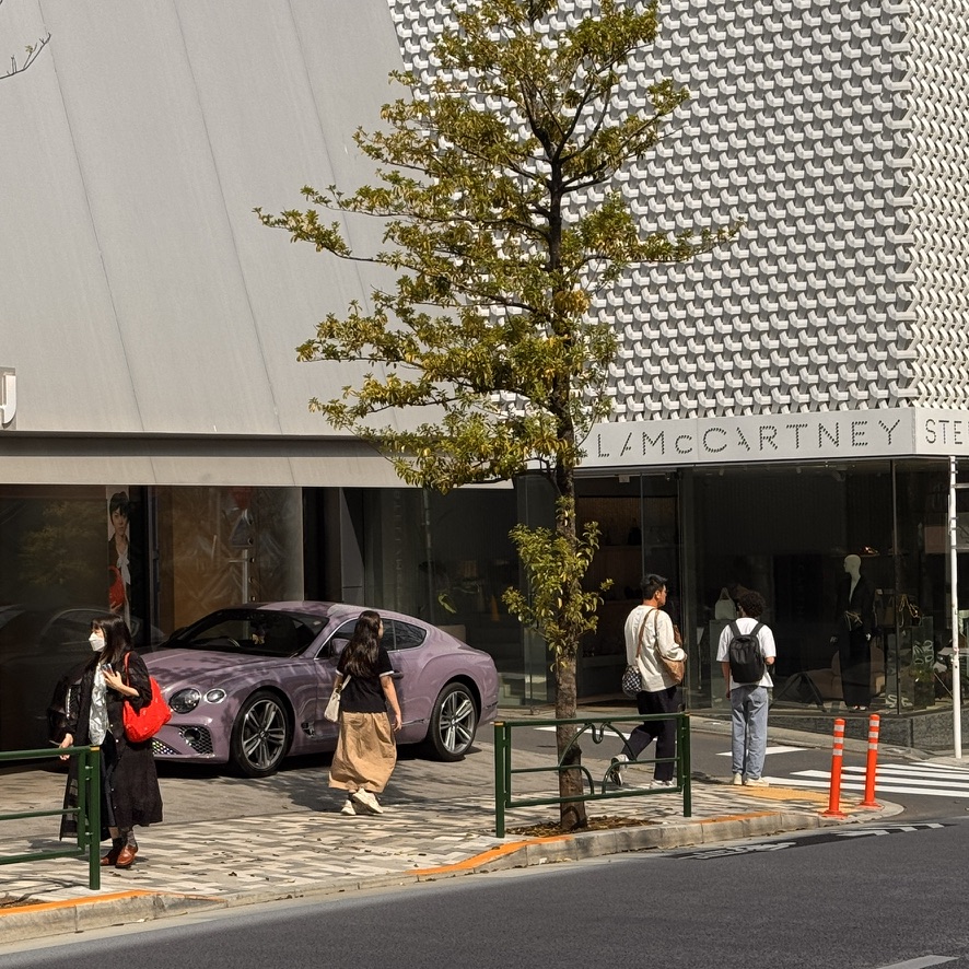
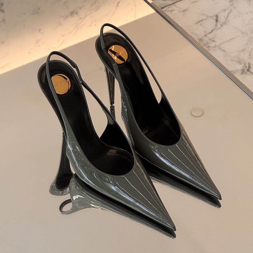
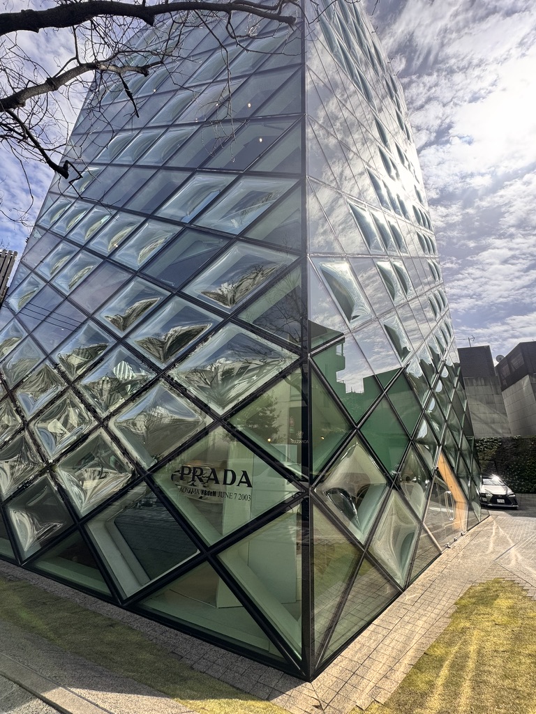
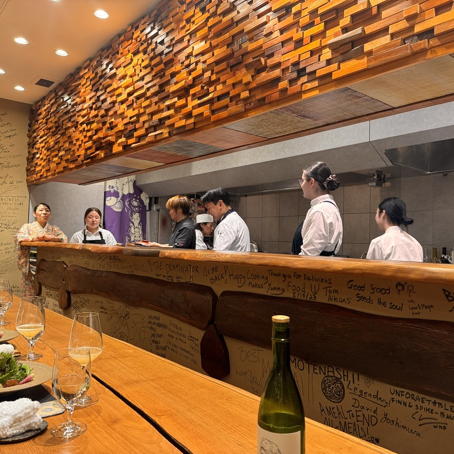
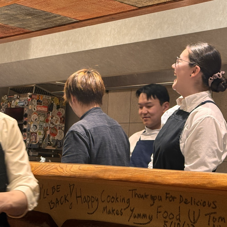
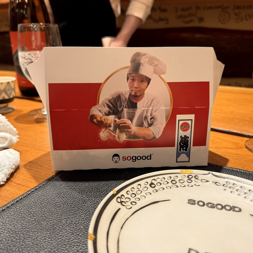
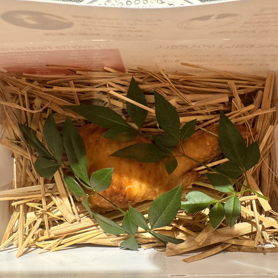
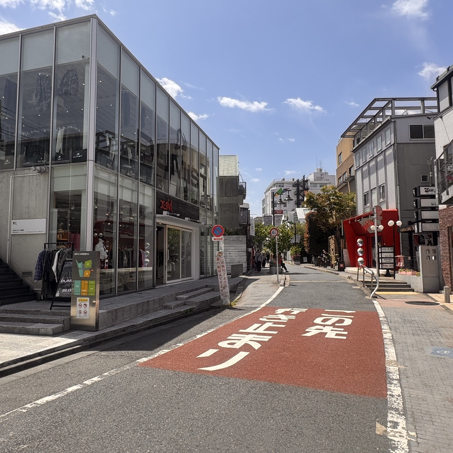
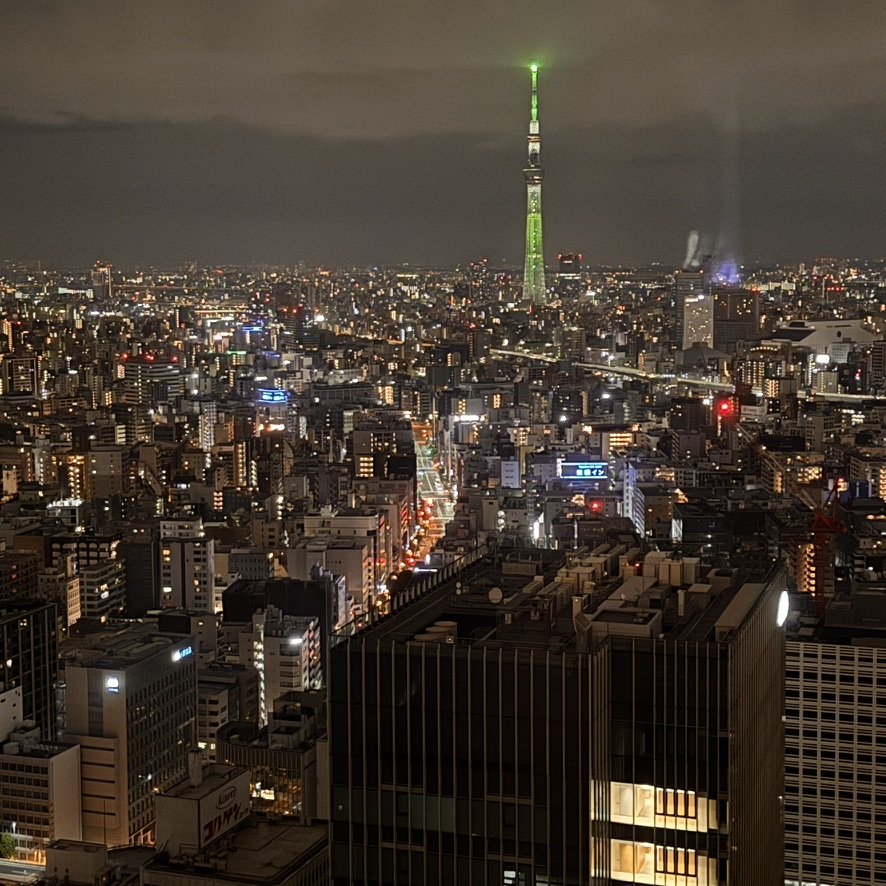
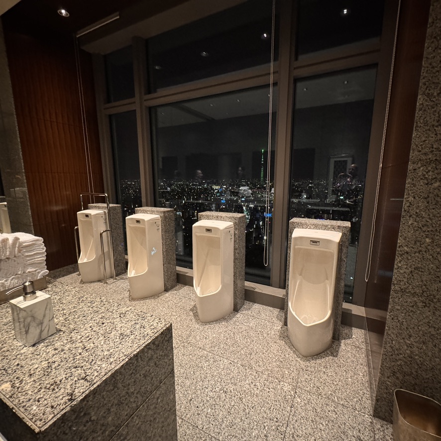
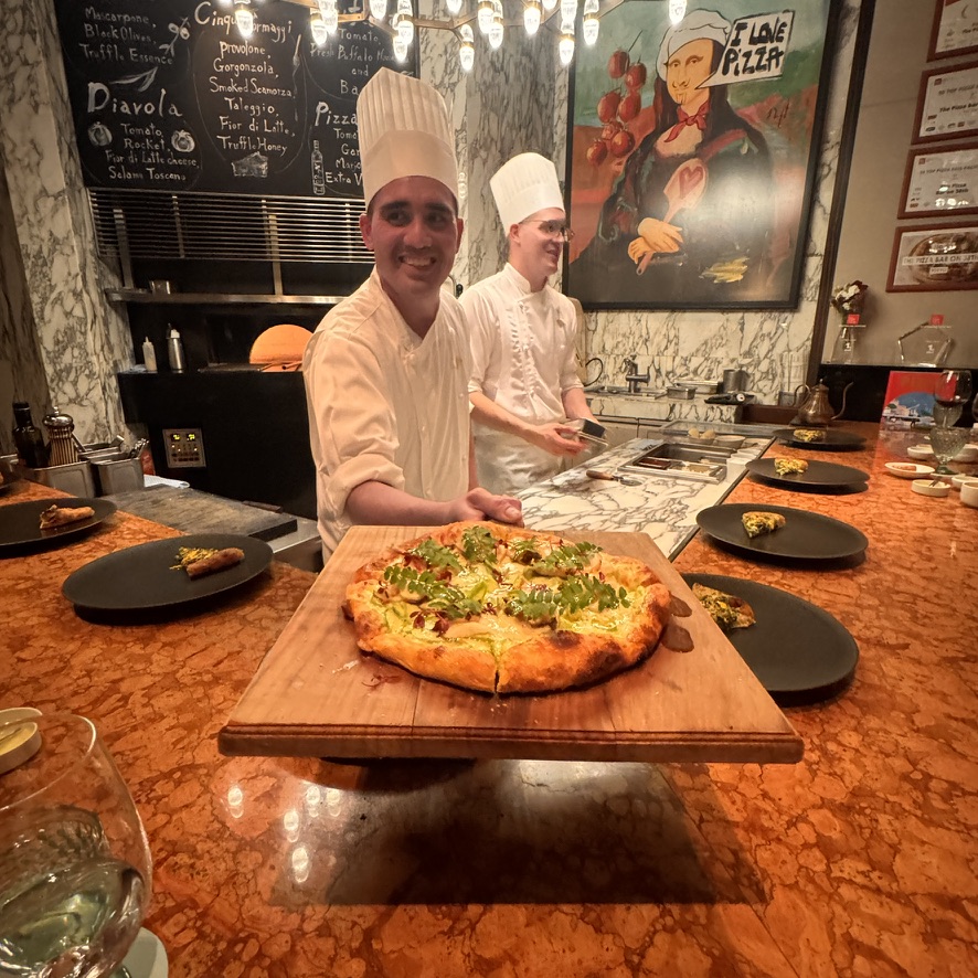
The map of Metro Tokyo’s outstanding and very clean subway system. On my first day I engaged the services of a local guide for five hours. His mission was to familiarize me with the underground and how it works. Together we traveled all over Tokyo. With that knowledge, I was able to get all over this city, and fairly quickly. If covering long distances in Tokyo it’s the only practical way to get around.On the subway, I see some of the working people of Tokyo. Please note how spotless the floor is. I suppose that if these six people were reading newspapers, instead of their devices, they would have to spread out. Otherwise they’d be reading each other’s papers.One of the many shopping districts in the city. The major international designers cannot only be found here, but also in many other locations in districts throughout the city. The United States has nothing on the Japanese when it comes to consumerism. New York has Fifth Avenue. Tokyo has it on steroids, and in many places all over the city.This Dior building has some very interesting architecture. It’s as though the rooftop gardens are going to spill over onto the sidewalk. Another thing I took note of in Tokyo was that no one J-walks. All pedestrians wait at the crosswalks for the lights to allow their safe crossing. Another manifestation of just how respectful this culture is.Professional dog walker operating at the Japanese level. Quite the orchestration of animals so as to prevent tangling. Think about how much time she must spend picking up poop.Open space near the center of government and the Imperial Palace. Geographically, this area is at the center of the entire Tokyo metropolitan area. It is also very close the financial center of Japan as well. Only a short walk from the open space above is the Seimon Ishibashi bridge at the Imperial Palace in the Chiyoda district of Tokyo.The Imperial Palace is pictured in the background. This is the residence of the Emperor of Japan.Shinto shrines are quite ubiquitous throughout Japan. Shinto is the nature-based spirituality of Japan. It dovetails quite nicely into Buddhism, the other popular belief system in Japan. More than eighty percent of Japanese participate in its traditions. They say that Shinto celebrates life and life events, while buddhism is prominent at death and funeral services.Here is one open market in the northeast corner of Tokyo.Just one of the many kiosk stands at the market.Now down to the always spotless subway. I encountered less non-Japanese people than I expected. This unknown woman was kind enough to stop and smile for my camera. She bears an uncanny likeness to that housekeeper I had years ago in Palermo, Sicily. Another Shinto shrine tucked in near the very fashionable Patek Philippe store. I was wondering how the Shinto afford the rent on this trendy location?No shortage of awesome machinery either. This mauve Bentley was parked just outside the Stella McCartney Boutique.Very expensive YSL footwear. Not only stylish, a pair of these could save your life in a knife fight.Prada makes a statement in its architecture alone. The building’s architecture just screams style with simplicity.Nighttime on the way to the Den omakase, an extremely in-demand restaurant. I had to make this reservation 60 days in advance. Also had to literally call 75 times to finally connect.I was seated inside the Den at the table-bar. The chef is the only one in black. His name is Zaiyu Hasegawa. The restaurant is located in the Shibuya district.Just like the graffiti says, watching them have such a good time while working to prepare dinner seems to make the food taste even better.Pictured here is the chef on the box of “Dentucky” fried chicken. The similarity to a KFC box is no coincidence.And inside the box is the very delicious nested chicken. It’s too bad it didn’t come by the bucket. It was “So Good,” just like the box says.Another quiet back street, and of course more stores. This image was shot just before opening hours.Nighttime in Tokyo from the Mandarin Oriental Hotel. The illuminated Stytree Tower tops out at 2,080 feet (634 meters). Gotta love this design in the hotel’s restroom. The entire country boasts not only the cleanest toilets in the world, but I was unable to encounter one that was not equipped with a bidet self-washing seat feature. Last dinner in Tokyo at the Pizza Bar on 38th. This restaurant was not only a nice departure from all the sushi I was consuming, but it won its Michelin Star in 2025.
Tomorrow I plan to take a bullet train to the mountains in the western part of Japan. The town is known as Kagaonsen. It will be quite the different from Tokyo. Hope to see you there.
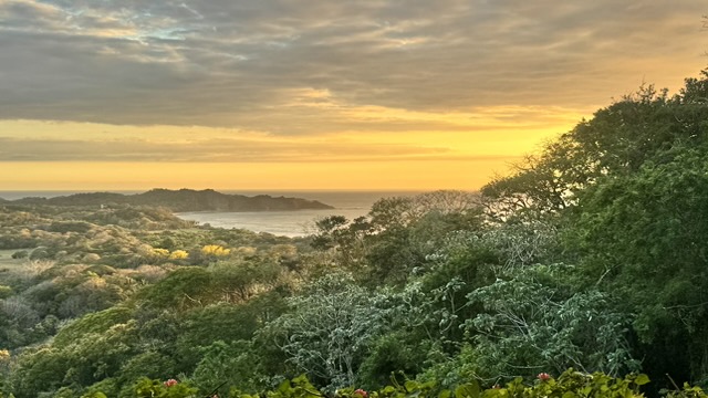
This place is a gem of an off-the-beaten path surf-town. Despite the fact that the Nicoya Peninsula in the Guanacaste province in the southwestern part of the country has the most unpaved roads in Costa Rica, Nosara is one of the oldest expatriate communities in the country. The restaurants, bars and hotels are more the adequate for a two week visit. There is an ordinance that prevents any construction on the beachfronts. Consequently, the beaches appear as though there is nothing around. This gives one the feeling of being even more remote then you really are. A helpful tip in getting here is to take the 30 minute flight from the San Juan Airport, rather than the 3-4 hour drive (half of which in on unpaved roads.) Having taken the road route, trust me, I would never do that again.
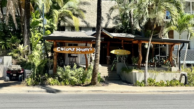
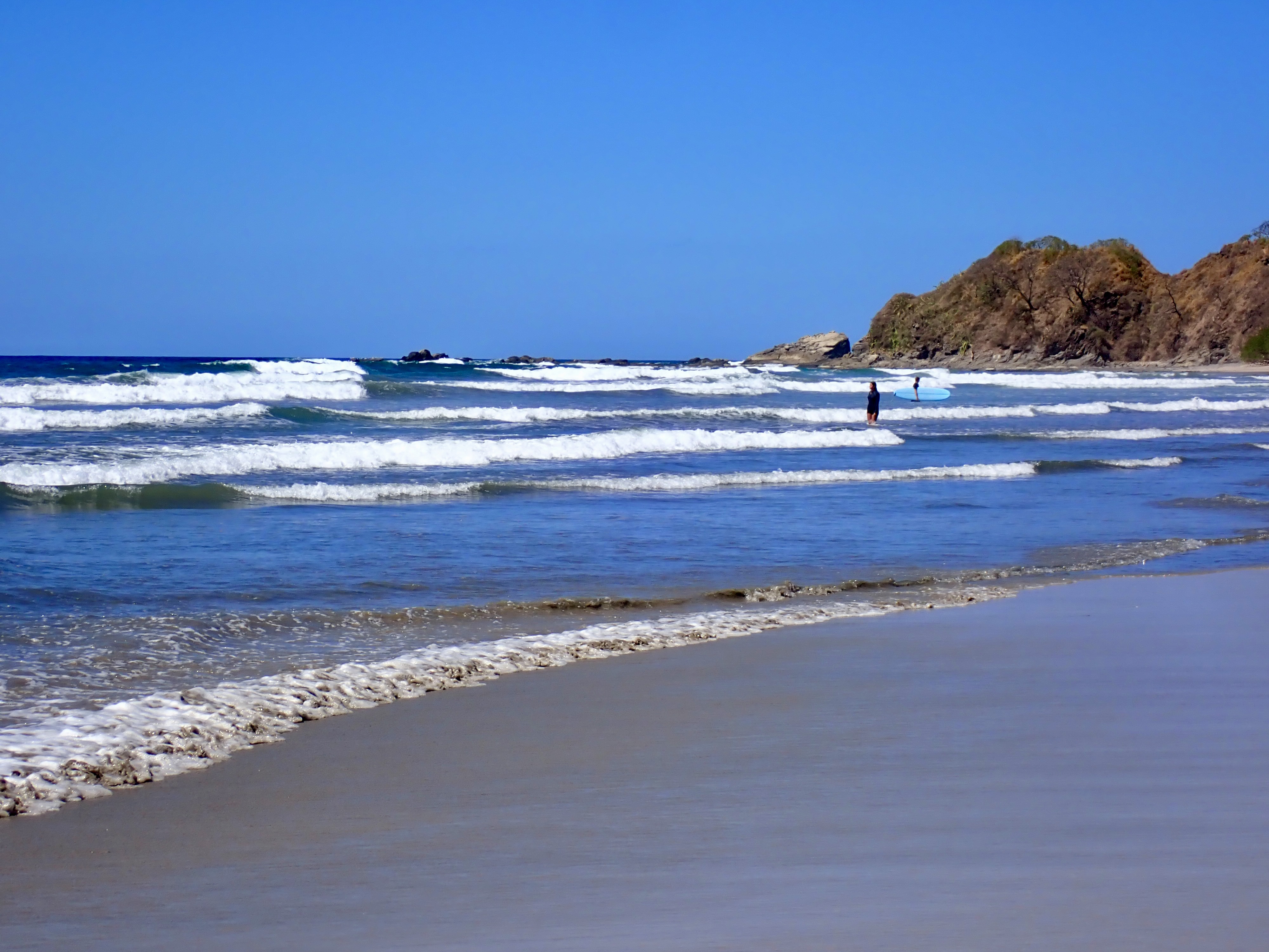
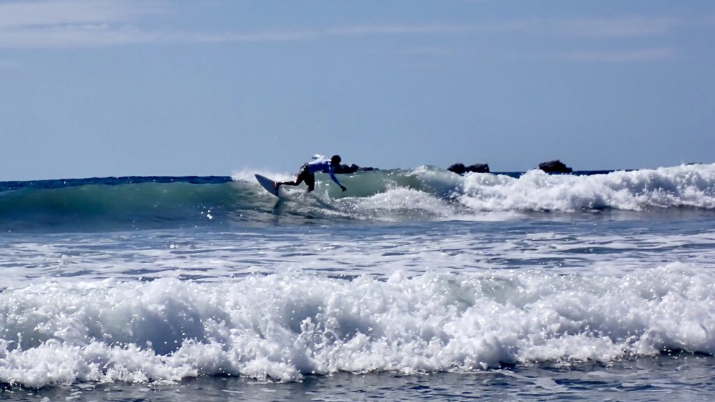
The monument letting you know that you have arrived here at the little surf town.Coconut Harry’s is typical of the surf shops in the area.While none of the waves are large, there are waves for everyone who is learning to surf. Beginner, intermediate, and advanced waves abound almost every day.Curving some turns in the waves. Just an awesome area to learn to surf. These waves flow every 15 seconds, so there is not much down time spent waiting for the next one.This spot is a great beach bar. “Howler’s” named for the local monkeys found climbing in trees above. The margaritas and cold local beers were perfect in the 86+ degree weather.The view of Howler’s from the unpaved road in front. They grow sugar cane here and the molasses byproduct is applied to the streets to keep the dust down. While it’s effective at dust mitigation, it leaves the soles of your shoes quite sticky.Howler’s never changing menu. Why change it when each item on the limited menu is great. I had lunch here at least 5 times in the 12 days I spent in the area.The very inviting hotel bar and restaurant at Sendero. The chef creates some really interesting and tasty menu items.Nosara has some shopping too. This shop was unique in that it has no doors. Consequently, everything must be packed up upon the store closing each the day.Mainstreet Nosara is paved. This is the street scene. There is a good mostly organic food store, and organic bakery, a bank and a lot more.Beautiful sunset up above Nosara. I had dinner at the Tierra Magnifica Hotel. The food was as amazing as the views.
So long from Costa Rica and the little surf town of Nosara.
Bosa and Alghero are two charming towns each in its own way. These stops were a nice variation from all the beaches and out of the way places I have been. I spent a morning in Bosa and then left for Alghero. The drive between the two was only 90 minutes but, was one of the most scenic I have experienced since I have been on the island. Bosa is small and I spent only one night, this seemed like the right amount of time. Alghero is quite a bit larger and has much more to do and see.
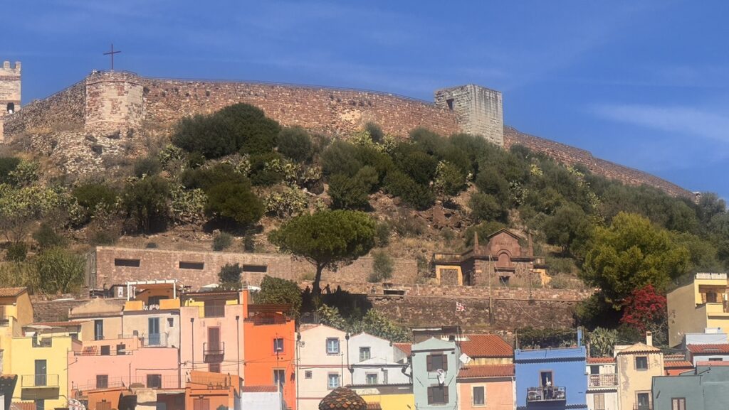
The colorful village of Bosa beneath the old fortress.View from the fortress down to the town of Bosa with the Bosa River running through it. Quite a picturesque setting for this little town.The ubiquitous Vespa seen here on the walk up to the fortress.The drive from Bosa to Alghero was amazing, just a stunning coast highway. at almost every point along the way.Looking south back to Bosa on the coastline between Bosa and Alghero.Old-town Alghero. This is where I chose to spend a couple of nights. Once I parked in a remote parking area to the old-town, it was a 15 minute walk to the guest house I would be staying. From there everything in the old-town is very walkable.This was my choice for lodging and it was a great one, only 12 rooms. The owner/proprietor gave me a wealth of information for restaurants to avoid, as well as ones to choose. He also acted as a great concierge and would make reservations for me. Since I was only here for a brief time, I didn’t want to waste one of the few dining experiences I would have on some mediocre restaurant. Early morning bustle on a typical old-town street with cafes, restaurants, and shops.This night-time street vender with the kind smile was selling trick boxes that were impossible to open without knowing the trick. He wouldn’t show you the trick until you purchased at least one box. I bought three of them.
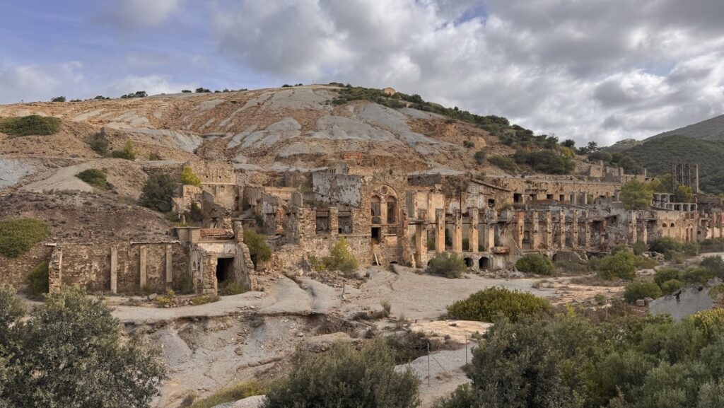
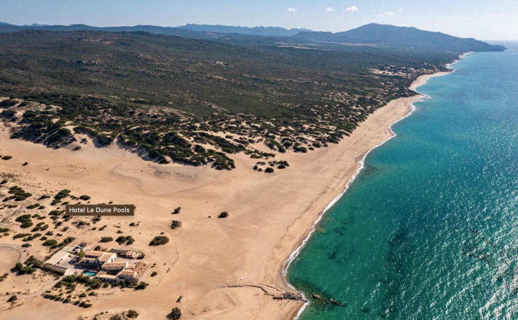
This area boasts europe’s tallest sand dunes, reaching over 70 meters (about 230 feet) high. This location is fairly remote and it’s crazy to find a Five-star hotel here. This eco-resort was built from a repurposed former mining warehouse. While the area has a wild and rugged coastline with untouched beauty, there are other activities besides the beach and feasting on the scenery in which to engage. Such activities include mine touring, visiting the mining ruins, horseback riding, diving, quad biking, yoga, and more.
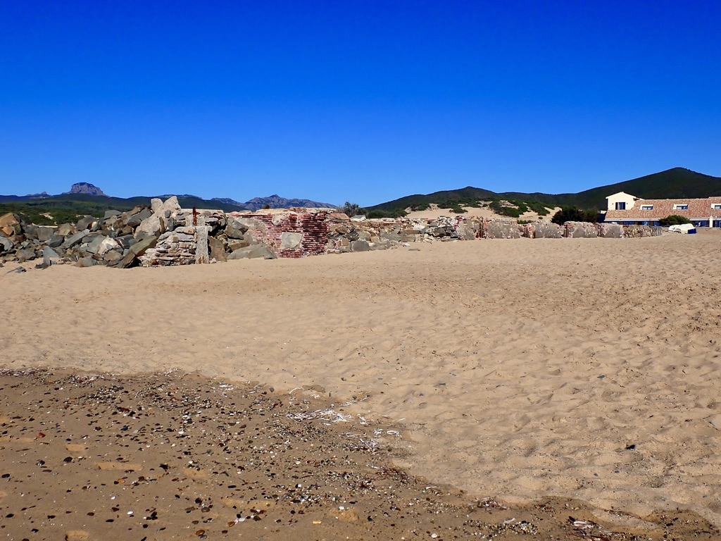
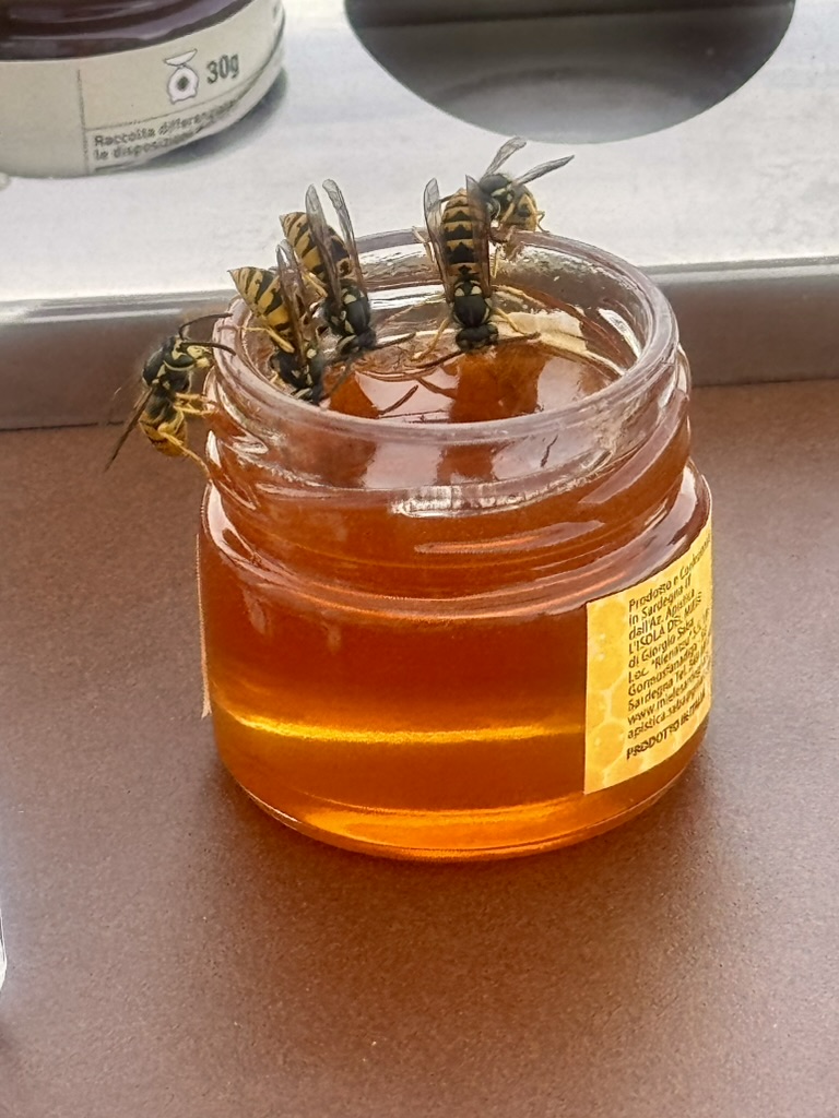
On the way to my final destination I stopped to explore some of the old mining ruins.Remnants of a very old mining site and factory dating back to 1850. The area here was chosen for its zinc, lead, and silver deposits. I wonder what these mine workers would think if they could see what is happening now 200 years later at the site of the eco-resort (formerly the mining warehouse.)Still some distance away to the coastline, the dunes can barely be seen far in the distance. That is also the location of what once-upon-a-time was the mining warehouse, now the eco-report Le Dune Piscinas.Drone perspective of the remote eco-resort. This image captures just how remote and secluded this place is. Also, barely visible in the foreground on the beach is the old pier. Back in the day this was used for the ships that would dock and then be loaded with the mined metals.This is a close up of the old shipping pier. I was glad that this was not removed when the hotel was created. While not beautiful to look at, it provides a link to the history of this place.This image was captured from the beach looking back to the hotel.At the beach the people are quite sparse. They are mostly camping nearby since there are no homes or lodging anywhere close to this location. The nearest town is Arbus, about 30 Km away, via mostly narrow winding dirt roads.Another perspective with some very rugged mountains in the background.Very welcoming hotel lounge. One of the many hotel sculptures around the property. In the off-season the hotel hosts an artist-in-residence program. The program invites contemporary artists to create works in dialogue with the surrounding landscape, the hotel, and its mining history.Relics and some art pieces as you walk to the beach.The giant beetle, while appearing to be menacing, is entirely harmless.Some company at breakfast. These are not bees and they do not sting. They are attracted to primarily food and flowers. I opened the honey (which they especially enjoy) so they wouldn’t bother me, and it worked.Great table for two and an incredible sunset happening. What a beautiful place for dinner. The menu was awesome too. That was critical because there are no other dining options anywhere nearby.
After a two night stay here I will be headed north for a bit. For my next stop I plan to see some small towns. Not exactly sure yet where that is, but I will know before I depart. Since there are many fewer towns and villages along Sardinia’s western coast the decision should be an easy one. Probably head to Bosa and then Alghero.
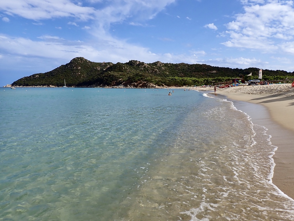
Chia is located on the southern coastline of Sardinia. I decided to spend only two nights here. The beaches were fabulous, the crystaline water was warm, and the sun was hot. The hotel I booked was The Baia di Chia Resort, part of the Curio collection by Conrad. It had 77 rooms on numerous hilly acres of coast-side land. Some of the cottages offered amazing views of the coastline. Since I was staying only two nights, I booked a superior cottage with an incredible view, as seen below.
View to the beach from my cottage near the top of the cliff..This perspective of the cliffside hotel cottages was taken from the lighthouse.A portion of the path down to the water. The only downside to the amazing views and privacy offered by my accommodations was the 80-100 steps down to the beach.The water felt as good as it looks.Pictured above is the lighthouse to which I hiked earlier in the day. The path can barely be seen just along the rocky plunge to the water.The view to the north from the lighthouse. Part of the charm here in Chia is the lack of commercial development. There was only one larger hotel. That hotel seemed like way too much for this area.The view to the south from the lighthouse. More amazing beaches as far as the eye can see.I hiked around the coastline for a couple of hours and discovered this nice secluded spot that someone was enjoying.And so my final morning here begins with this glorious sunrise over the lighthouse.
And that’s it for this stop on my island tour. After breakfast I will drive north and then west to the coast. I am heading to a very secluded and unique hotel. The journey to this very secluded spot will take three to four hours along some very challenging roads. See you there at Le Dune Piscinas.
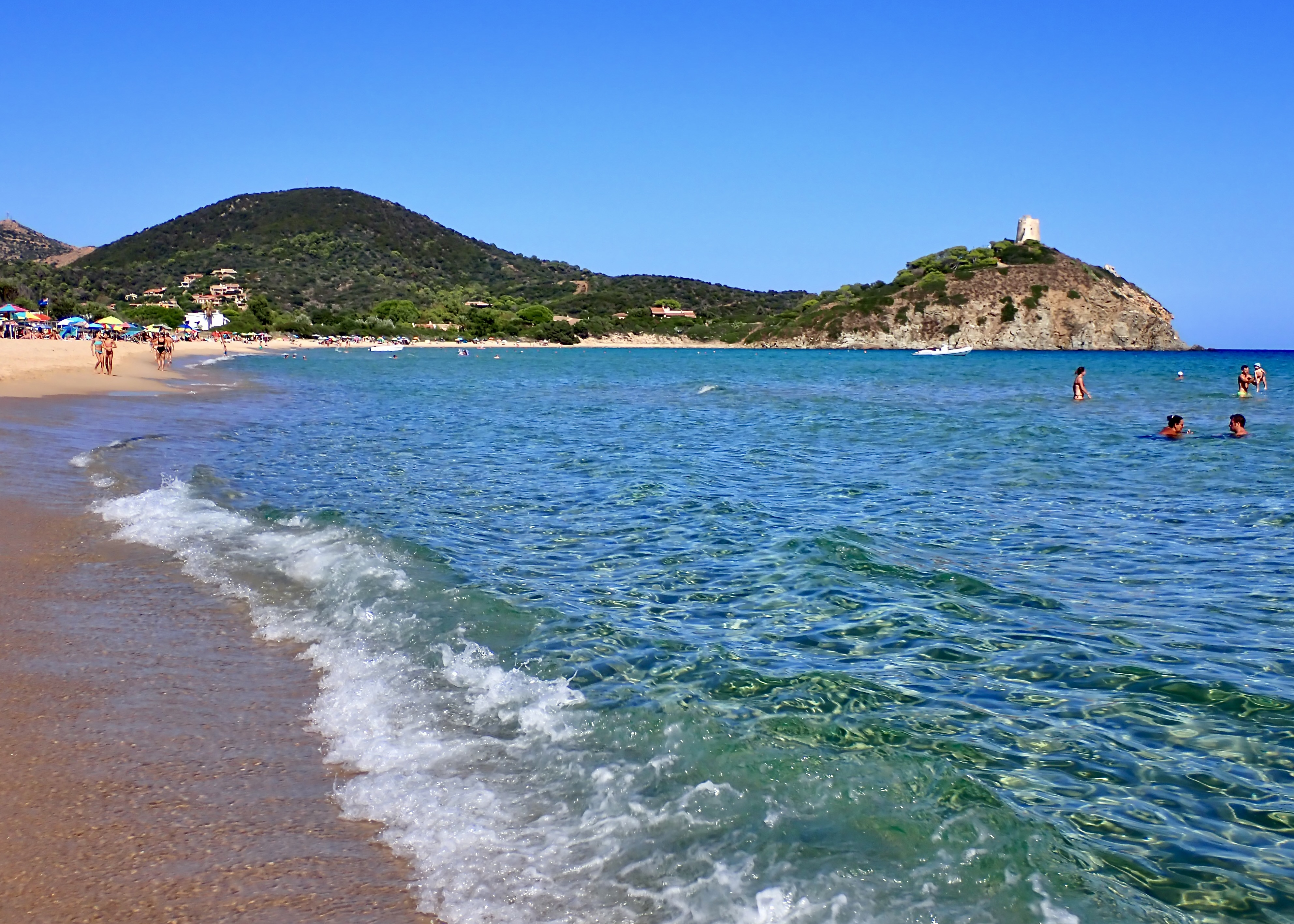
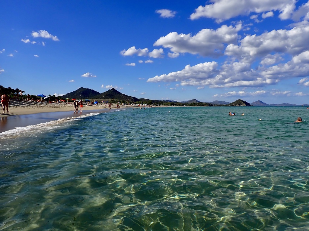
Cala di Sinzias is located near the very southeast point on Sardinia. I found a great hotel with a great location to a stunning beach. The hotel dining options left something to be desired. However, there was an awesome beach restaurant named Lido Tamatete. Serving both Italian and Mediterranean fare I took full advantage of this place and proceeded to eat lunch and dinners here. The beach and Tamatete were a short 10 minute walk through the forest from the hotel. When I wasn’t at Tamatete I spent most of my time in the water or on the beach. I’m sure there was more here to do, but I never found it. The beach scene was it for two days.
These are the typical hotel accommodations at Hotel Cala Sinzias Resort. Modest yet fully functional units. The property had a spa, gym, several private pools, and plenty of well maintained gardens.Hotel pool was both inviting and nearly empty at the same moment. I believe it’s because the beach was such an incredible draw.The walk through the woods and then some dunes near the beach. I’m beginning to resemble my stone friend here.More of the dunes on the walk to the beach. This place is both scenic and raw. Just a stunning beach in both directions. This is the view to the north. The greenish color of the water is a direct result of the golden sand and the steep angle of the sun. Here’s the beach view to the south. Notice how the water color is different from the image above. This was taken mid-day when the angle of the sun was more direct.Another pic of this beautiful water.This is an example of an “organized beach” offering chairs, drinks and some food. It’s hard not to notice the coordinated chairs and umbrellas. It looks organized.This is an example of a “disorganized beach”, offering many colored umbrellas and some congestion. Here it is hard not to notice the clashing umbrellas, towels and chairs. But who really cares anyway, we’re all at the beach.Lunchtime view of the beach from my table at Tamatete. A table in the shade with an awesome view, a bowl of hot mussels, and an ice cold Peroni beer. Sometimes the simple things in life are the best. The name of this establishment is painted in blue and white on the large rock in the foreground.Restaurant Tamatete as evening comes to the beach.
That’s it from this place. My research indicates that I will drive 2-3 hours tomorrow mostly along the southern coastline on my way to the town of Chia. Chia is located on the southwest part of Sardinia. See you there.
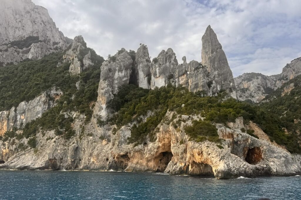
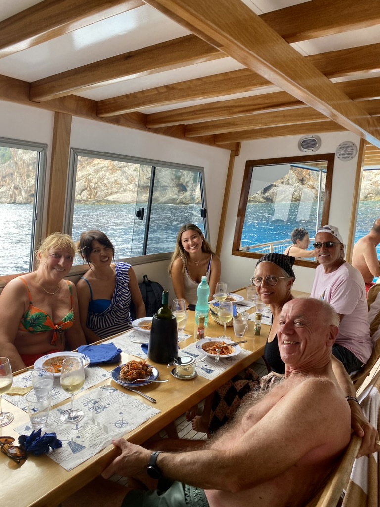
The Golfo di Orosei was only a 3 hour drive south from the La Maddalena district. It was also in the general direction of my plan to travel clockwise around the entire island. Since there are no paved roads and very few dirt or rocky roads to the coastline, the only viable access is from the water. Consequently, I decided to take a full-day boat excursion in order to explore this beautiful rugged coastline on the eastern side of the island. I also believe that the best views are to be experienced from the water. Our charter had 11 other guests from various parts of the world. I befriended some Brits, and a mother and daughter from Japan. It made for a very enjoyable day. The charter provided beer, wine and a hot lunch.
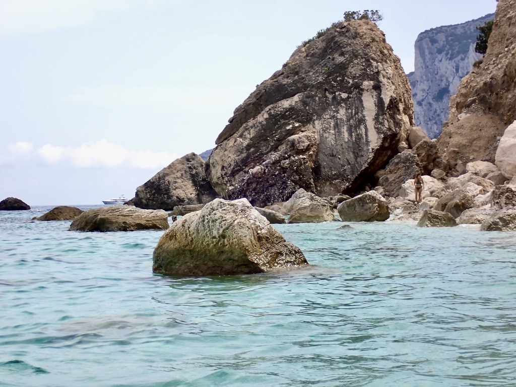
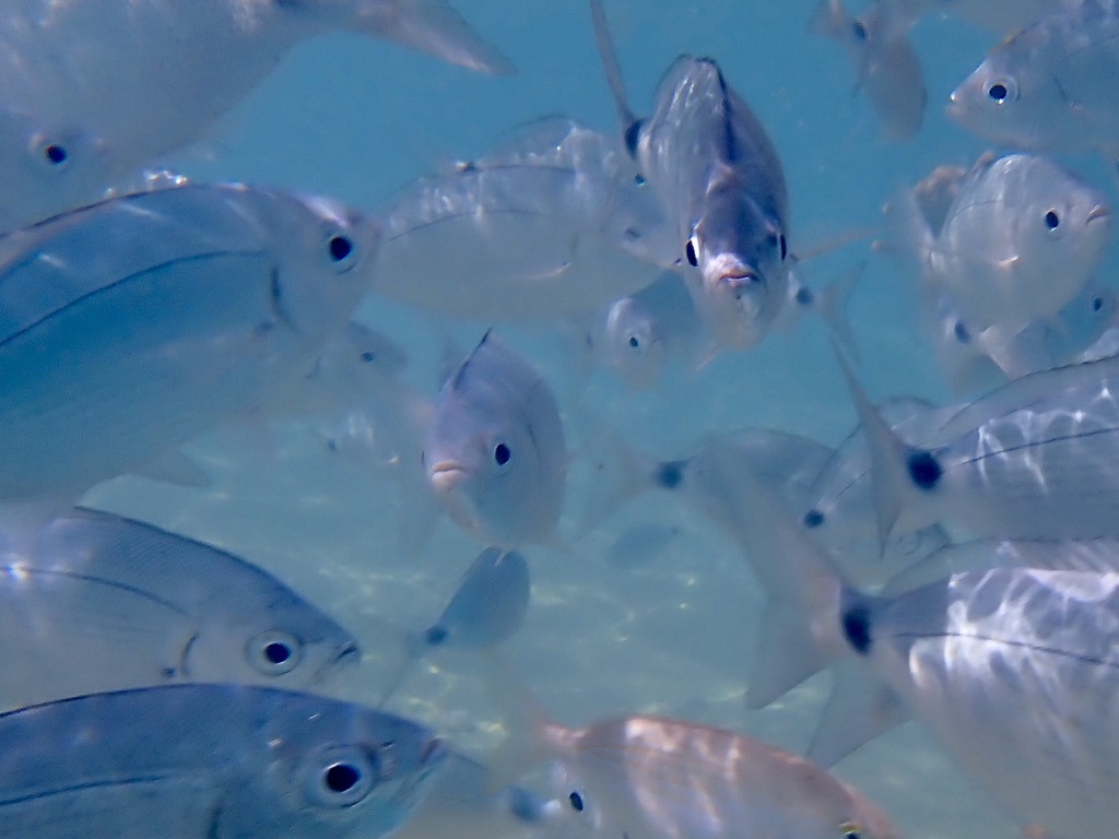
Some of the rugged coastline along the Golfo di Orosei.Another area and some of the granite spires dramatically surging up from the coastline.Because of today’s partly-cloudy skies, there were fewer people at the beaches where we stopped to swim.One of the few beaches along the Golfo di Orosei. This point in the foreground provided a great spot to jump-off into the water, as well as a fabulous view.Another beach, another view.These are my new friends enjoying lunch and some white wine on the boat as we motor toward another beach.Everywhere I swam there were fish. I love the expression on the fish staring straight at me. What would he say if he could talk?
Next, I plan I will be traveling to Cala di Sinzias, which is very near the most southeastern point I can drive on the island. My research indicates that it’s a place worth checking-out. Hope you can join me.